You are here: Home > Network List > UW - Pacific Northwest Regional Seismic Network Stations List
> Station FISH Seaside, OR, USA > Earthquake Result Viewer
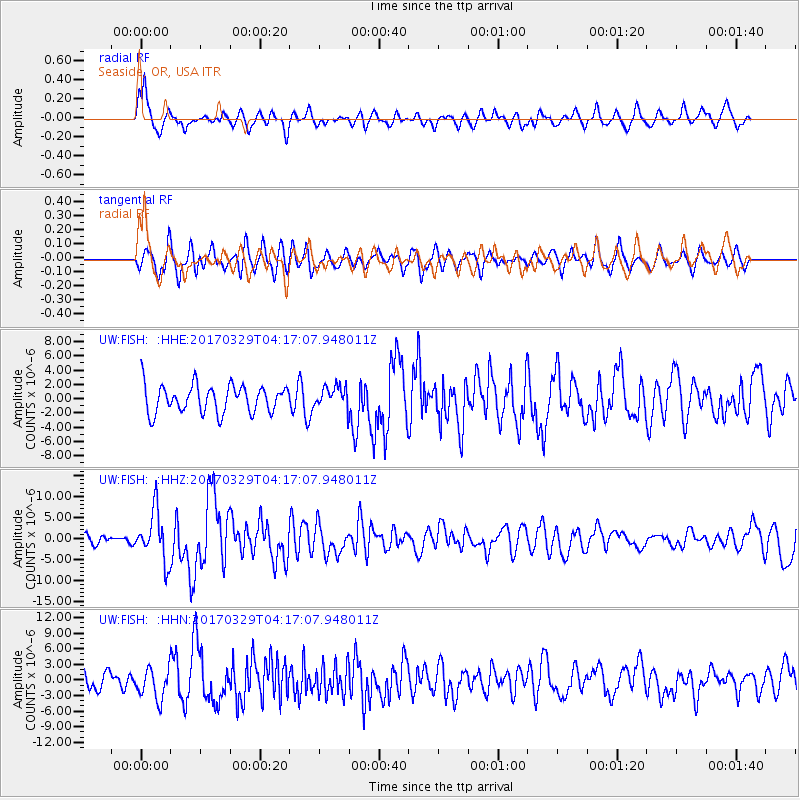
FISH Seaside, OR, USA - Earthquake Result Viewer
*The percent match for this event was below the threshold and hence no stack was calculated.
| Earthquake location: |
Near East Coast Of Kamchatka |
| Earthquake latitude/longitude: |
56.9/162.7 |
| Earthquake time(UTC): |
2017/03/29 (088) 04:09:24 GMT |
| Earthquake Depth: |
23 km |
| Earthquake Magnitude: |
6.6 Mww |
| Earthquake Catalog/Contributor: |
NEIC PDE/us |
|
| Network: |
UW Pacific Northwest Regional Seismic Network |
| Station: |
FISH Seaside, OR, USA |
| Lat/Lon: |
45.93 N/123.56 W |
| Elevation: |
325 m |
|
| Distance: |
45.1 deg |
| Az: |
71.129 deg |
| Baz: |
311.972 deg |
| Ray Param: |
$rayparam |
*The percent match for this event was below the threshold and hence was not used in the summary stack. |
|
| Radial Match: |
66.80442 % |
| Radial Bump: |
400 |
| Transverse Match: |
56.80766 % |
| Transverse Bump: |
400 |
| SOD ConfigId: |
11737051 |
| Insert Time: |
2019-04-27 00:31:10.121 +0000 |
| GWidth: |
2.5 |
| Max Bumps: |
400 |
| Tol: |
0.001 |
|
Signal To Noise
| Channel | StoN | STA | LTA |
| UW:FISH: :HHZ:20170329T04:17:07.948011Z | 5.2418537 | 5.940904E-6 | 1.1333593E-6 |
| UW:FISH: :HHN:20170329T04:17:07.948011Z | 1.1086988 | 2.951739E-6 | 2.662345E-6 |
| UW:FISH: :HHE:20170329T04:17:07.948011Z | 0.85734963 | 1.6144827E-6 | 1.8831088E-6 |
| Arrivals |
| Ps | |
| PpPs | |
| PsPs/PpSs | |


