You are here: Home > Network List > CI - Caltech Regional Seismic Network Stations List
> Station DAN Danby, California, USA > Earthquake Result Viewer
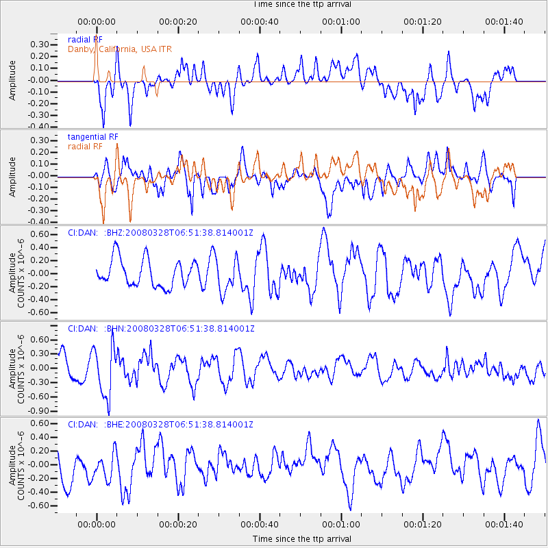
DAN Danby, California, USA - Earthquake Result Viewer
*The percent match for this event was below the threshold and hence no stack was calculated.
| Earthquake location: |
South Of Kermadec Islands |
| Earthquake latitude/longitude: |
-32.9/179.4 |
| Earthquake time(UTC): |
2008/03/28 (088) 06:39:47 GMT |
| Earthquake Depth: |
365 km |
| Earthquake Magnitude: |
5.6 MW, 5.3 MB, 5.5 MW |
| Earthquake Catalog/Contributor: |
WHDF/NEIC |
|
| Network: |
CI Caltech Regional Seismic Network |
| Station: |
DAN Danby, California, USA |
| Lat/Lon: |
34.64 N/115.38 W |
| Elevation: |
398 m |
|
| Distance: |
90.9 deg |
| Az: |
48.499 deg |
| Baz: |
229.844 deg |
| Ray Param: |
$rayparam |
*The percent match for this event was below the threshold and hence was not used in the summary stack. |
|
| Radial Match: |
66.380264 % |
| Radial Bump: |
400 |
| Transverse Match: |
63.33676 % |
| Transverse Bump: |
400 |
| SOD ConfigId: |
2504 |
| Insert Time: |
2010-02-26 01:05:43.083 +0000 |
| GWidth: |
2.5 |
| Max Bumps: |
400 |
| Tol: |
0.001 |
|
Signal To Noise
| Channel | StoN | STA | LTA |
| CI:DAN: :BHN:20080328T06:51:38.814001Z | 2.2094862 | 5.3395246E-7 | 2.4166363E-7 |
| CI:DAN: :BHE:20080328T06:51:38.814001Z | 0.7158284 | 2.1412356E-7 | 2.9912692E-7 |
| CI:DAN: :BHZ:20080328T06:51:38.814001Z | 1.2254665 | 2.53937E-7 | 2.072166E-7 |
| Arrivals |
| Ps | |
| PpPs | |
| PsPs/PpSs | |


