You are here: Home > Network List > IU - Global Seismograph Network (GSN - IRIS/USGS) Stations List
> Station PMG Port Moresby, New Guinea > Earthquake Result Viewer
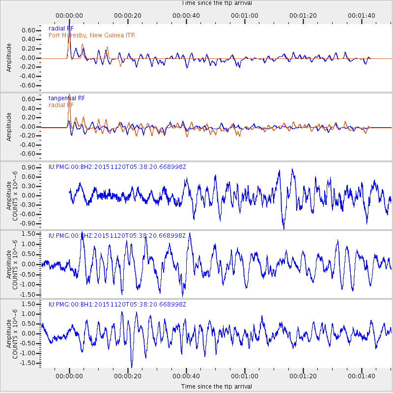
PMG Port Moresby, New Guinea - Earthquake Result Viewer
*The percent match for this event was below the threshold and hence no stack was calculated.
| Earthquake location: |
Bonin Islands, Japan Region |
| Earthquake latitude/longitude: |
26.4/142.7 |
| Earthquake time(UTC): |
2015/11/20 (324) 05:31:52 GMT |
| Earthquake Depth: |
13 km |
| Earthquake Magnitude: |
5.5 MB |
| Earthquake Catalog/Contributor: |
NEIC PDE/NEIC COMCAT |
|
| Network: |
IU Global Seismograph Network (GSN - IRIS/USGS) |
| Station: |
PMG Port Moresby, New Guinea |
| Lat/Lon: |
9.40 S/147.16 E |
| Elevation: |
90 m |
|
| Distance: |
35.8 deg |
| Az: |
172.478 deg |
| Baz: |
353.165 deg |
| Ray Param: |
$rayparam |
*The percent match for this event was below the threshold and hence was not used in the summary stack. |
|
| Radial Match: |
72.77596 % |
| Radial Bump: |
400 |
| Transverse Match: |
63.906578 % |
| Transverse Bump: |
400 |
| SOD ConfigId: |
1259291 |
| Insert Time: |
2015-12-04 06:26:55.658 +0000 |
| GWidth: |
2.5 |
| Max Bumps: |
400 |
| Tol: |
0.001 |
|
Signal To Noise
| Channel | StoN | STA | LTA |
| IU:PMG:00:BHZ:20151120T05:38:20.668998Z | 4.599327 | 6.304784E-7 | 1.3708058E-7 |
| IU:PMG:00:BH1:20151120T05:38:20.668998Z | 1.8047392 | 3.8893896E-7 | 2.1550979E-7 |
| IU:PMG:00:BH2:20151120T05:38:20.668998Z | 1.2333946 | 1.7232827E-7 | 1.397187E-7 |
| Arrivals |
| Ps | |
| PpPs | |
| PsPs/PpSs | |


