You are here: Home > Network List > US - United States National Seismic Network Stations List
> Station LONY Lake Ozonia, New York, USA > Earthquake Result Viewer
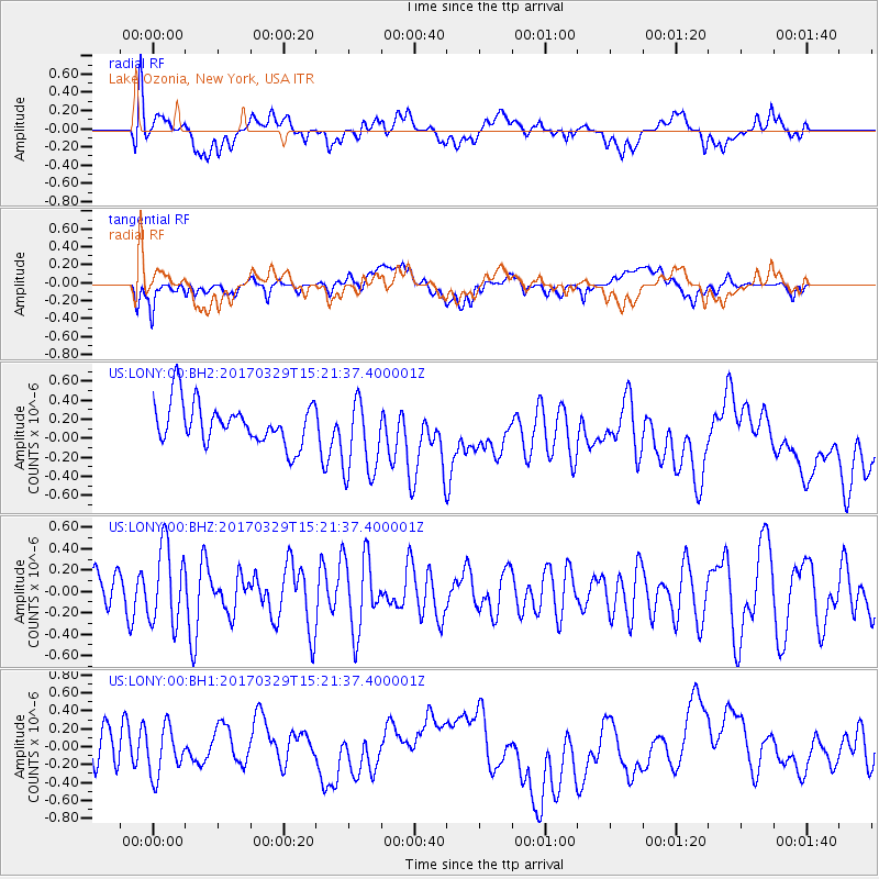
LONY Lake Ozonia, New York, USA - Earthquake Result Viewer
*The percent match for this event was below the threshold and hence no stack was calculated.
| Earthquake location: |
Gulf Of California |
| Earthquake latitude/longitude: |
26.0/-110.0 |
| Earthquake time(UTC): |
2017/03/29 (088) 15:15:26 GMT |
| Earthquake Depth: |
10 km |
| Earthquake Magnitude: |
5.7 Mww |
| Earthquake Catalog/Contributor: |
NEIC PDE/us |
|
| Network: |
US United States National Seismic Network |
| Station: |
LONY Lake Ozonia, New York, USA |
| Lat/Lon: |
44.62 N/74.58 W |
| Elevation: |
440 m |
|
| Distance: |
34.0 deg |
| Az: |
47.733 deg |
| Baz: |
248.843 deg |
| Ray Param: |
$rayparam |
*The percent match for this event was below the threshold and hence was not used in the summary stack. |
|
| Radial Match: |
44.529625 % |
| Radial Bump: |
400 |
| Transverse Match: |
34.183876 % |
| Transverse Bump: |
400 |
| SOD ConfigId: |
11737051 |
| Insert Time: |
2019-04-27 00:37:38.639 +0000 |
| GWidth: |
2.5 |
| Max Bumps: |
400 |
| Tol: |
0.001 |
|
Signal To Noise
| Channel | StoN | STA | LTA |
| US:LONY:00:BHZ:20170329T15:21:37.400001Z | 1.6466644 | 3.6291564E-7 | 2.2039443E-7 |
| US:LONY:00:BH1:20170329T15:21:37.400001Z | 1.2019681 | 2.5990732E-7 | 2.1623481E-7 |
| US:LONY:00:BH2:20170329T15:21:37.400001Z | 1.4429882 | 3.4590695E-7 | 2.3971572E-7 |
| Arrivals |
| Ps | |
| PpPs | |
| PsPs/PpSs | |


