You are here: Home > Network List > TA - USArray Transportable Network (new EarthScope stations) Stations List
> Station R31K City Hall, Gustavus, AK, USA > Earthquake Result Viewer
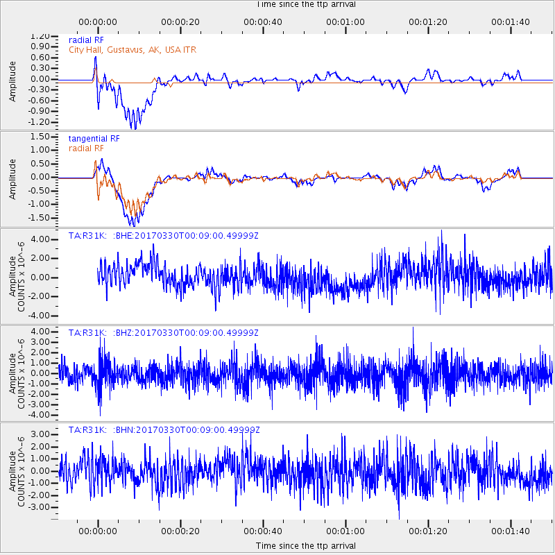
R31K City Hall, Gustavus, AK, USA - Earthquake Result Viewer
*The percent match for this event was below the threshold and hence no stack was calculated.
| Earthquake location: |
Vanuatu Islands |
| Earthquake latitude/longitude: |
-19.4/168.8 |
| Earthquake time(UTC): |
2017/03/29 (088) 23:56:39 GMT |
| Earthquake Depth: |
57 km |
| Earthquake Magnitude: |
5.4 Mww |
| Earthquake Catalog/Contributor: |
NEIC PDE/us |
|
| Network: |
TA USArray Transportable Network (new EarthScope stations) |
| Station: |
R31K City Hall, Gustavus, AK, USA |
| Lat/Lon: |
58.41 N/135.74 W |
| Elevation: |
15 m |
|
| Distance: |
89.9 deg |
| Az: |
25.678 deg |
| Baz: |
231.007 deg |
| Ray Param: |
$rayparam |
*The percent match for this event was below the threshold and hence was not used in the summary stack. |
|
| Radial Match: |
34.066605 % |
| Radial Bump: |
400 |
| Transverse Match: |
30.287659 % |
| Transverse Bump: |
400 |
| SOD ConfigId: |
11737051 |
| Insert Time: |
2019-04-27 00:42:58.672 +0000 |
| GWidth: |
2.5 |
| Max Bumps: |
400 |
| Tol: |
0.001 |
|
Signal To Noise
| Channel | StoN | STA | LTA |
| TA:R31K: :BHZ:20170330T00:09:00.49999Z | 1.6008167 | 1.3083659E-6 | 8.1731145E-7 |
| TA:R31K: :BHN:20170330T00:09:00.49999Z | 1.1546247 | 9.709969E-7 | 8.409632E-7 |
| TA:R31K: :BHE:20170330T00:09:00.49999Z | 1.0731609 | 1.1741462E-6 | 1.0941009E-6 |
| Arrivals |
| Ps | |
| PpPs | |
| PsPs/PpSs | |


