You are here: Home > Network List > TA - USArray Transportable Network (new EarthScope stations) Stations List
> Station H24K Noodor Dome, AK, USA > Earthquake Result Viewer
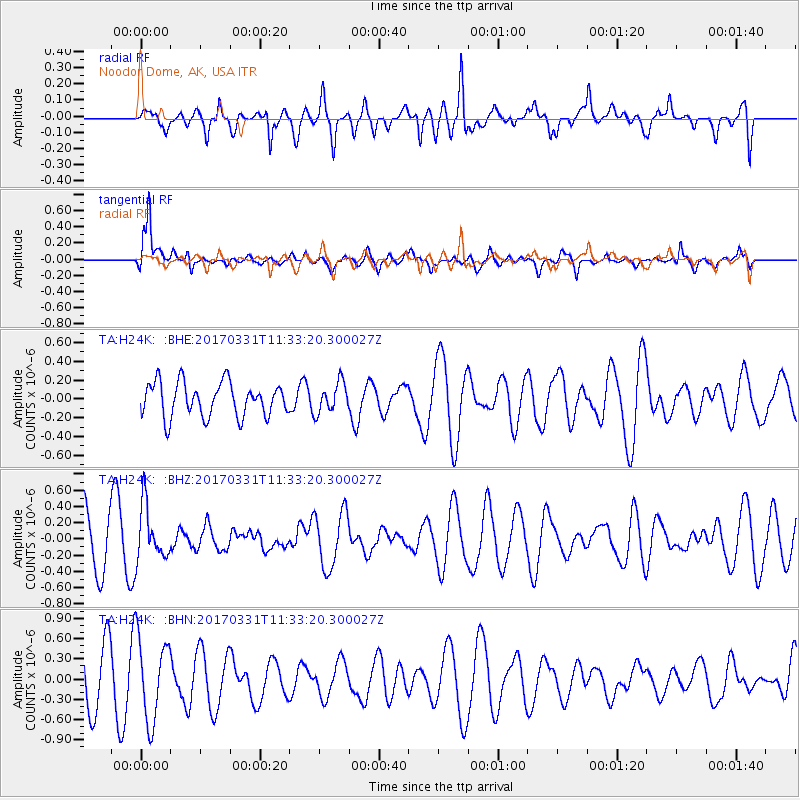
H24K Noodor Dome, AK, USA - Earthquake Result Viewer
*The percent match for this event was below the threshold and hence no stack was calculated.
| Earthquake location: |
Minahassa Peninsula, Sulawesi |
| Earthquake latitude/longitude: |
0.3/120.6 |
| Earthquake time(UTC): |
2017/03/31 (090) 11:21:00 GMT |
| Earthquake Depth: |
93 km |
| Earthquake Magnitude: |
5.6 mb |
| Earthquake Catalog/Contributor: |
NEIC PDE/us |
|
| Network: |
TA USArray Transportable Network (new EarthScope stations) |
| Station: |
H24K Noodor Dome, AK, USA |
| Lat/Lon: |
65.84 N/147.88 W |
| Elevation: |
814 m |
|
| Distance: |
90.3 deg |
| Az: |
24.298 deg |
| Baz: |
271.503 deg |
| Ray Param: |
$rayparam |
*The percent match for this event was below the threshold and hence was not used in the summary stack. |
|
| Radial Match: |
57.152397 % |
| Radial Bump: |
400 |
| Transverse Match: |
67.91929 % |
| Transverse Bump: |
388 |
| SOD ConfigId: |
11737051 |
| Insert Time: |
2019-04-27 00:47:23.968 +0000 |
| GWidth: |
2.5 |
| Max Bumps: |
400 |
| Tol: |
0.001 |
|
Signal To Noise
| Channel | StoN | STA | LTA |
| TA:H24K: :BHZ:20170331T11:33:20.300027Z | 1.153316 | 3.344161E-7 | 2.899605E-7 |
| TA:H24K: :BHN:20170331T11:33:20.300027Z | 1.6950206 | 6.123159E-7 | 3.612439E-7 |
| TA:H24K: :BHE:20170331T11:33:20.300027Z | 0.8934854 | 1.6154694E-7 | 1.8080534E-7 |
| Arrivals |
| Ps | |
| PpPs | |
| PsPs/PpSs | |


