You are here: Home > Network List > TJ - Tajikistan National Seismic Network Stations List
> Station GARM Garm, Tajikistan > Earthquake Result Viewer
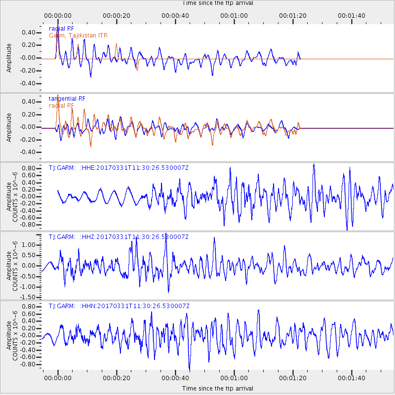
GARM Garm, Tajikistan - Earthquake Result Viewer
*The percent match for this event was below the threshold and hence no stack was calculated.
| Earthquake location: |
Minahassa Peninsula, Sulawesi |
| Earthquake latitude/longitude: |
0.3/120.6 |
| Earthquake time(UTC): |
2017/03/31 (090) 11:21:00 GMT |
| Earthquake Depth: |
93 km |
| Earthquake Magnitude: |
5.6 mb |
| Earthquake Catalog/Contributor: |
NEIC PDE/us |
|
| Network: |
TJ Tajikistan National Seismic Network |
| Station: |
GARM Garm, Tajikistan |
| Lat/Lon: |
39.00 N/70.32 E |
| Elevation: |
1305 m |
|
| Distance: |
59.9 deg |
| Az: |
316.138 deg |
| Baz: |
117.22 deg |
| Ray Param: |
$rayparam |
*The percent match for this event was below the threshold and hence was not used in the summary stack. |
|
| Radial Match: |
72.07063 % |
| Radial Bump: |
400 |
| Transverse Match: |
68.66686 % |
| Transverse Bump: |
400 |
| SOD ConfigId: |
11737051 |
| Insert Time: |
2019-04-27 00:47:38.255 +0000 |
| GWidth: |
2.5 |
| Max Bumps: |
400 |
| Tol: |
0.001 |
|
Signal To Noise
| Channel | StoN | STA | LTA |
| TJ:GARM: :HHZ:20170331T11:30:26.530007Z | 2.6515281 | 3.5254624E-7 | 1.3295966E-7 |
| TJ:GARM: :HHN:20170331T11:30:26.530007Z | 2.5042257 | 1.7453605E-7 | 6.969661E-8 |
| TJ:GARM: :HHE:20170331T11:30:26.530007Z | 1.3746103 | 1.7303351E-7 | 1.2587823E-7 |
| Arrivals |
| Ps | |
| PpPs | |
| PsPs/PpSs | |


