You are here: Home > Network List > CI - Caltech Regional Seismic Network Stations List
> Station BAR Barrett, Tecate, CA, USA > Earthquake Result Viewer
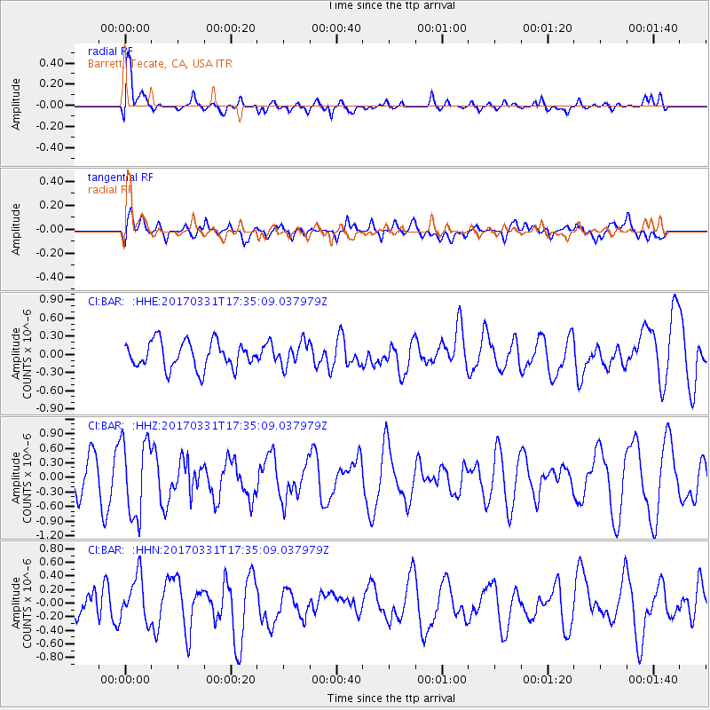
BAR Barrett, Tecate, CA, USA - Earthquake Result Viewer
*The percent match for this event was below the threshold and hence no stack was calculated.
| Earthquake location: |
Reykjanes Ridge |
| Earthquake latitude/longitude: |
52.7/-32.3 |
| Earthquake time(UTC): |
2017/03/31 (090) 17:25:23 GMT |
| Earthquake Depth: |
10 km |
| Earthquake Magnitude: |
5.5 Mww |
| Earthquake Catalog/Contributor: |
NEIC PDE/us |
|
| Network: |
CI Caltech Regional Seismic Network |
| Station: |
BAR Barrett, Tecate, CA, USA |
| Lat/Lon: |
32.68 N/116.67 W |
| Elevation: |
521 m |
|
| Distance: |
61.5 deg |
| Az: |
287.305 deg |
| Baz: |
43.581 deg |
| Ray Param: |
$rayparam |
*The percent match for this event was below the threshold and hence was not used in the summary stack. |
|
| Radial Match: |
69.87927 % |
| Radial Bump: |
400 |
| Transverse Match: |
42.057693 % |
| Transverse Bump: |
400 |
| SOD ConfigId: |
11737051 |
| Insert Time: |
2019-04-27 00:50:17.017 +0000 |
| GWidth: |
2.5 |
| Max Bumps: |
400 |
| Tol: |
0.001 |
|
Signal To Noise
| Channel | StoN | STA | LTA |
| CI:BAR: :HHZ:20170331T17:35:09.037979Z | 2.4438899 | 7.8765373E-7 | 3.222951E-7 |
| CI:BAR: :HHN:20170331T17:35:09.037979Z | 2.3800316 | 3.4559548E-7 | 1.4520627E-7 |
| CI:BAR: :HHE:20170331T17:35:09.037979Z | 0.89173365 | 1.9528572E-7 | 2.1899557E-7 |
| Arrivals |
| Ps | |
| PpPs | |
| PsPs/PpSs | |


