You are here: Home > Network List > TA - USArray Transportable Network (new EarthScope stations) Stations List
> Station A36M Sachs Harbour, NT, CAN > Earthquake Result Viewer
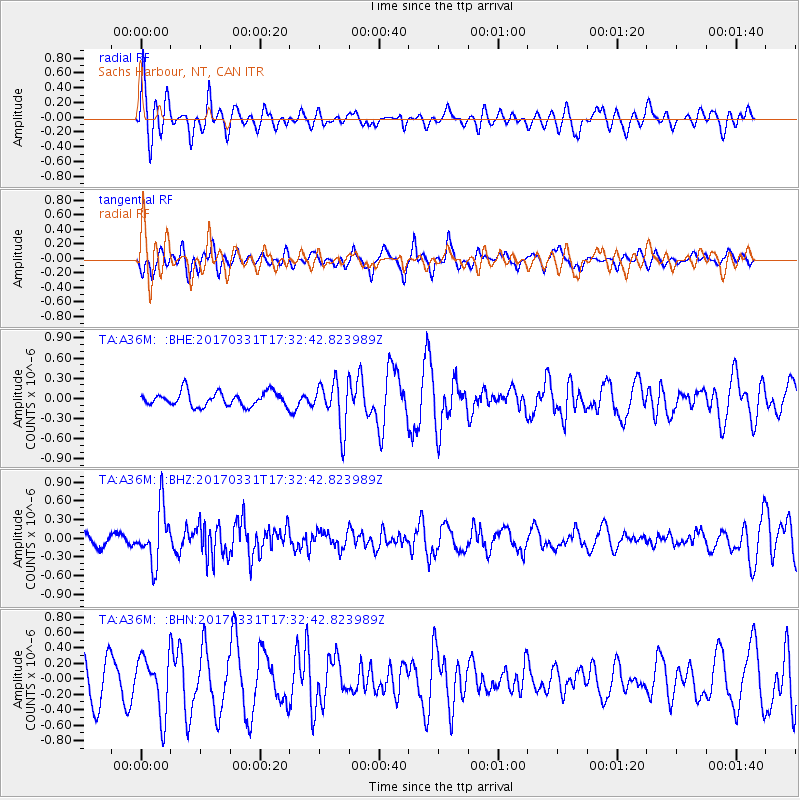
A36M Sachs Harbour, NT, CAN - Earthquake Result Viewer
*The percent match for this event was below the threshold and hence no stack was calculated.
| Earthquake location: |
Reykjanes Ridge |
| Earthquake latitude/longitude: |
52.7/-32.3 |
| Earthquake time(UTC): |
2017/03/31 (090) 17:25:23 GMT |
| Earthquake Depth: |
10 km |
| Earthquake Magnitude: |
5.5 Mww |
| Earthquake Catalog/Contributor: |
NEIC PDE/us |
|
| Network: |
TA USArray Transportable Network (new EarthScope stations) |
| Station: |
A36M Sachs Harbour, NT, CAN |
| Lat/Lon: |
71.99 N/125.25 W |
| Elevation: |
32 m |
|
| Distance: |
41.9 deg |
| Az: |
332.282 deg |
| Baz: |
65.558 deg |
| Ray Param: |
$rayparam |
*The percent match for this event was below the threshold and hence was not used in the summary stack. |
|
| Radial Match: |
71.302826 % |
| Radial Bump: |
400 |
| Transverse Match: |
37.72526 % |
| Transverse Bump: |
301 |
| SOD ConfigId: |
11737051 |
| Insert Time: |
2019-04-27 00:55:08.818 +0000 |
| GWidth: |
2.5 |
| Max Bumps: |
400 |
| Tol: |
0.001 |
|
Signal To Noise
| Channel | StoN | STA | LTA |
| TA:A36M: :BHZ:20170331T17:32:42.823989Z | 4.784797 | 4.360398E-7 | 9.113026E-8 |
| TA:A36M: :BHN:20170331T17:32:42.823989Z | 1.6160707 | 3.7453233E-7 | 2.3175491E-7 |
| TA:A36M: :BHE:20170331T17:32:42.823989Z | 3.3305306 | 3.505341E-7 | 1.0524872E-7 |
| Arrivals |
| Ps | |
| PpPs | |
| PsPs/PpSs | |


