You are here: Home > Network List > TA - USArray Transportable Network (new EarthScope stations) Stations List
> Station O20A White River City, CO, USA > Earthquake Result Viewer
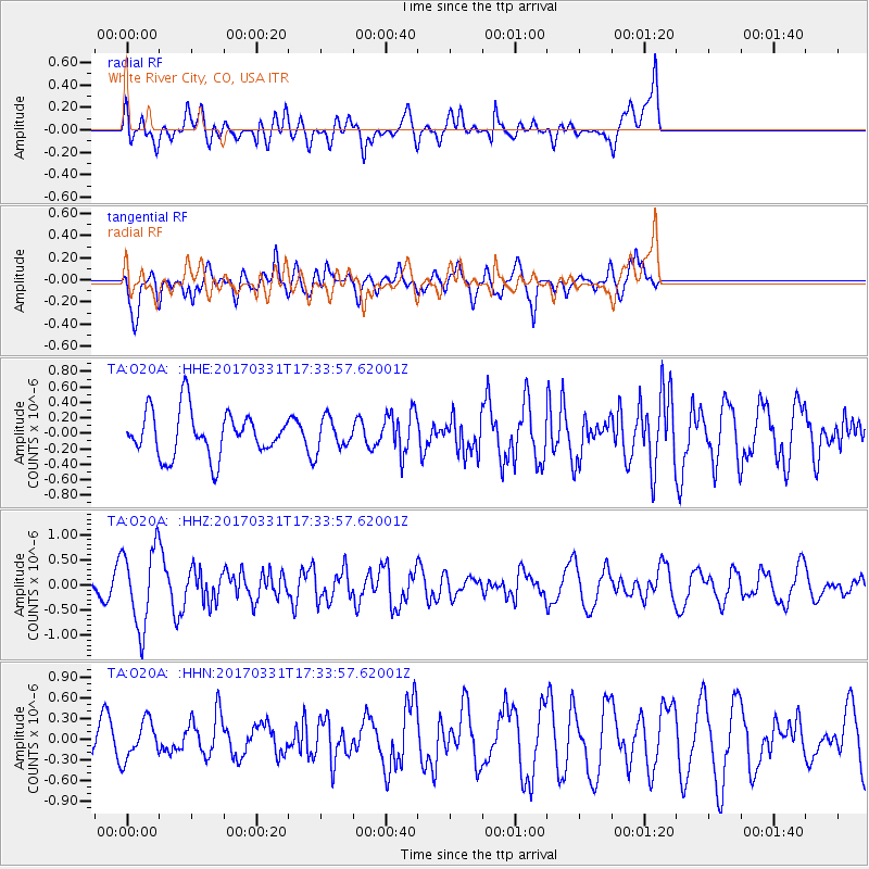
O20A White River City, CO, USA - Earthquake Result Viewer
*The percent match for this event was below the threshold and hence no stack was calculated.
| Earthquake location: |
Reykjanes Ridge |
| Earthquake latitude/longitude: |
52.7/-32.3 |
| Earthquake time(UTC): |
2017/03/31 (090) 17:25:23 GMT |
| Earthquake Depth: |
10 km |
| Earthquake Magnitude: |
5.5 Mww |
| Earthquake Catalog/Contributor: |
NEIC PDE/us |
|
| Network: |
TA USArray Transportable Network (new EarthScope stations) |
| Station: |
O20A White River City, CO, USA |
| Lat/Lon: |
40.13 N/108.24 W |
| Elevation: |
1915 m |
|
| Distance: |
51.5 deg |
| Az: |
288.104 deg |
| Baz: |
49.022 deg |
| Ray Param: |
$rayparam |
*The percent match for this event was below the threshold and hence was not used in the summary stack. |
|
| Radial Match: |
52.786602 % |
| Radial Bump: |
400 |
| Transverse Match: |
63.00042 % |
| Transverse Bump: |
400 |
| SOD ConfigId: |
11737051 |
| Insert Time: |
2019-04-27 00:55:32.693 +0000 |
| GWidth: |
2.5 |
| Max Bumps: |
400 |
| Tol: |
0.001 |
|
Signal To Noise
| Channel | StoN | STA | LTA |
| TA:O20A: :HHZ:20170331T17:33:57.62001Z | 1.8743032 | 7.814881E-7 | 4.1694858E-7 |
| TA:O20A: :HHN:20170331T17:33:57.62001Z | 0.9999947 | 2.738024E-7 | 2.7380386E-7 |
| TA:O20A: :HHE:20170331T17:33:57.62001Z | 0.68955946 | 1.9997287E-7 | 2.900009E-7 |
| Arrivals |
| Ps | |
| PpPs | |
| PsPs/PpSs | |


