You are here: Home > Network List > TJ - Tajikistan National Seismic Network Stations List
> Station GARM Garm, Tajikistan > Earthquake Result Viewer
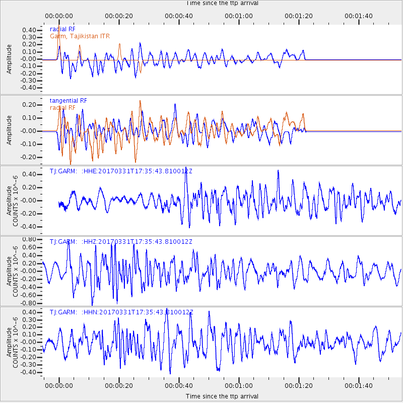
GARM Garm, Tajikistan - Earthquake Result Viewer
*The percent match for this event was below the threshold and hence no stack was calculated.
| Earthquake location: |
Reykjanes Ridge |
| Earthquake latitude/longitude: |
52.7/-32.3 |
| Earthquake time(UTC): |
2017/03/31 (090) 17:25:23 GMT |
| Earthquake Depth: |
10 km |
| Earthquake Magnitude: |
5.5 Mww |
| Earthquake Catalog/Contributor: |
NEIC PDE/us |
|
| Network: |
TJ Tajikistan National Seismic Network |
| Station: |
GARM Garm, Tajikistan |
| Lat/Lon: |
39.00 N/70.32 E |
| Elevation: |
1305 m |
|
| Distance: |
66.8 deg |
| Az: |
55.797 deg |
| Baz: |
319.734 deg |
| Ray Param: |
$rayparam |
*The percent match for this event was below the threshold and hence was not used in the summary stack. |
|
| Radial Match: |
72.41835 % |
| Radial Bump: |
400 |
| Transverse Match: |
54.56575 % |
| Transverse Bump: |
400 |
| SOD ConfigId: |
11737051 |
| Insert Time: |
2019-04-27 00:55:48.095 +0000 |
| GWidth: |
2.5 |
| Max Bumps: |
400 |
| Tol: |
0.001 |
|
Signal To Noise
| Channel | StoN | STA | LTA |
| TJ:GARM: :HHZ:20170331T17:35:43.810012Z | 3.3060992 | 3.0526556E-7 | 9.233406E-8 |
| TJ:GARM: :HHN:20170331T17:35:43.810012Z | 1.5468717 | 1.2905136E-7 | 8.3427324E-8 |
| TJ:GARM: :HHE:20170331T17:35:43.810012Z | 1.040946 | 8.4423235E-8 | 8.1102414E-8 |
| Arrivals |
| Ps | |
| PpPs | |
| PsPs/PpSs | |


