You are here: Home > Network List > CI - Caltech Regional Seismic Network Stations List
> Station DAN Danby, California, USA > Earthquake Result Viewer
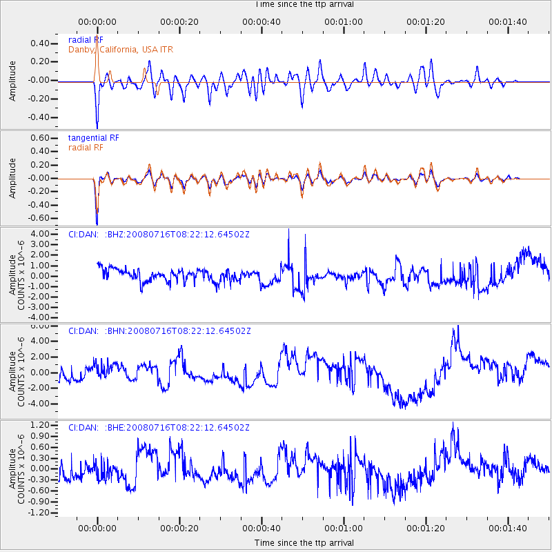
DAN Danby, California, USA - Earthquake Result Viewer
*The percent match for this event was below the threshold and hence no stack was calculated.
| Earthquake location: |
Samoa Islands Region |
| Earthquake latitude/longitude: |
-16.6/-173.0 |
| Earthquake time(UTC): |
2008/07/16 (198) 08:11:04 GMT |
| Earthquake Depth: |
10 km |
| Earthquake Magnitude: |
5.5 MB, 5.4 MS, 5.7 MW, 5.7 MW |
| Earthquake Catalog/Contributor: |
WHDF/NEIC |
|
| Network: |
CI Caltech Regional Seismic Network |
| Station: |
DAN Danby, California, USA |
| Lat/Lon: |
34.64 N/115.38 W |
| Elevation: |
398 m |
|
| Distance: |
74.7 deg |
| Az: |
46.178 deg |
| Baz: |
237.036 deg |
| Ray Param: |
$rayparam |
*The percent match for this event was below the threshold and hence was not used in the summary stack. |
|
| Radial Match: |
62.847992 % |
| Radial Bump: |
400 |
| Transverse Match: |
75.30179 % |
| Transverse Bump: |
400 |
| SOD ConfigId: |
2504 |
| Insert Time: |
2010-02-26 01:05:55.358 +0000 |
| GWidth: |
2.5 |
| Max Bumps: |
400 |
| Tol: |
0.001 |
|
Signal To Noise
| Channel | StoN | STA | LTA |
| CI:DAN: :BHN:20080716T08:22:12.64502Z | 1.7694308 | 1.1854314E-6 | 6.6995074E-7 |
| CI:DAN: :BHE:20080716T08:22:12.64502Z | 0.96005213 | 1.9554793E-7 | 2.0368469E-7 |
| CI:DAN: :BHZ:20080716T08:22:12.64502Z | 1.1450566 | 6.3050095E-7 | 5.506286E-7 |
| Arrivals |
| Ps | |
| PpPs | |
| PsPs/PpSs | |


