You are here: Home > Network List > CI - Caltech Regional Seismic Network Stations List
> Station DAN Danby, California, USA > Earthquake Result Viewer
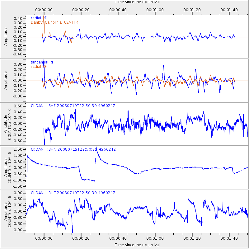
DAN Danby, California, USA - Earthquake Result Viewer
*The percent match for this event was below the threshold and hence no stack was calculated.
| Earthquake location: |
Fiji Islands Region |
| Earthquake latitude/longitude: |
-17.3/-177.3 |
| Earthquake time(UTC): |
2008/07/19 (201) 22:39:52 GMT |
| Earthquake Depth: |
391 km |
| Earthquake Magnitude: |
5.9 MB, 6.4 MW, 6.4 MW |
| Earthquake Catalog/Contributor: |
WHDF/NEIC |
|
| Network: |
CI Caltech Regional Seismic Network |
| Station: |
DAN Danby, California, USA |
| Lat/Lon: |
34.64 N/115.38 W |
| Elevation: |
398 m |
|
| Distance: |
78.3 deg |
| Az: |
47.991 deg |
| Baz: |
239.397 deg |
| Ray Param: |
$rayparam |
*The percent match for this event was below the threshold and hence was not used in the summary stack. |
|
| Radial Match: |
50.885876 % |
| Radial Bump: |
383 |
| Transverse Match: |
46.63489 % |
| Transverse Bump: |
400 |
| SOD ConfigId: |
2504 |
| Insert Time: |
2010-02-26 01:05:56.942 +0000 |
| GWidth: |
2.5 |
| Max Bumps: |
400 |
| Tol: |
0.001 |
|
Signal To Noise
| Channel | StoN | STA | LTA |
| CI:DAN: :BHN:20080719T22:50:39.496021Z | 1.0707369 | 4.492807E-7 | 4.1959956E-7 |
| CI:DAN: :BHE:20080719T22:50:39.496021Z | 0.8997589 | 3.0774714E-7 | 3.420329E-7 |
| CI:DAN: :BHZ:20080719T22:50:39.496021Z | 0.43561664 | 9.577937E-8 | 2.1987078E-7 |
| Arrivals |
| Ps | |
| PpPs | |
| PsPs/PpSs | |


