You are here: Home > Network List > GS - US Geological Survey Networks Stations List
> Station KAN13 Rinehart Farm, , CA, USA > Earthquake Result Viewer
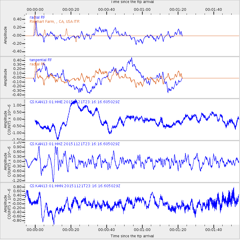
KAN13 Rinehart Farm, , CA, USA - Earthquake Result Viewer
*The percent match for this event was below the threshold and hence no stack was calculated.
| Earthquake location: |
Near Coast Of Central Chile |
| Earthquake latitude/longitude: |
-30.6/-71.8 |
| Earthquake time(UTC): |
2015/11/21 (325) 23:05:29 GMT |
| Earthquake Depth: |
24 km |
| Earthquake Magnitude: |
5.5 MB |
| Earthquake Catalog/Contributor: |
NEIC PDE/NEIC COMCAT |
|
| Network: |
GS US Geological Survey Networks |
| Station: |
KAN13 Rinehart Farm, , CA, USA |
| Lat/Lon: |
37.01 N/97.48 W |
| Elevation: |
340 m |
|
| Distance: |
71.4 deg |
| Az: |
338.535 deg |
| Baz: |
156.78 deg |
| Ray Param: |
$rayparam |
*The percent match for this event was below the threshold and hence was not used in the summary stack. |
|
| Radial Match: |
25.724066 % |
| Radial Bump: |
400 |
| Transverse Match: |
14.184767 % |
| Transverse Bump: |
400 |
| SOD ConfigId: |
1259291 |
| Insert Time: |
2015-12-05 23:20:54.839 +0000 |
| GWidth: |
2.5 |
| Max Bumps: |
400 |
| Tol: |
0.001 |
|
Signal To Noise
| Channel | StoN | STA | LTA |
| GS:KAN13:01:HHZ:20151121T23:16:16.605029Z | 2.7311351 | 4.63885E-7 | 1.6985061E-7 |
| GS:KAN13:01:HHN:20151121T23:16:16.605029Z | 1.3769852 | 4.778945E-7 | 3.4705857E-7 |
| GS:KAN13:01:HHE:20151121T23:16:16.605029Z | 1.0097811 | 7.7615755E-7 | 7.686394E-7 |
| Arrivals |
| Ps | |
| PpPs | |
| PsPs/PpSs | |


