You are here: Home > Network List > TA - USArray Transportable Network (new EarthScope stations) Stations List
> Station 833A Chaparral WMA, Artesia Wells, TX, USA > Earthquake Result Viewer
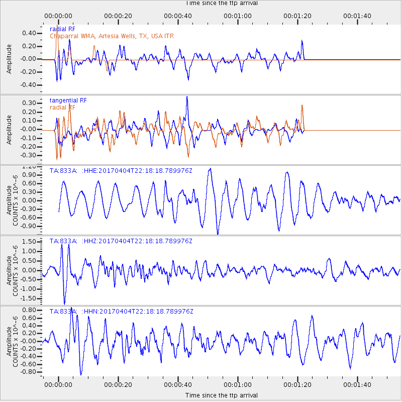
833A Chaparral WMA, Artesia Wells, TX, USA - Earthquake Result Viewer
*The percent match for this event was below the threshold and hence no stack was calculated.
| Earthquake location: |
Andreanof Islands, Aleutian Is. |
| Earthquake latitude/longitude: |
51.3/-176.4 |
| Earthquake time(UTC): |
2017/04/04 (094) 22:08:40 GMT |
| Earthquake Depth: |
13 km |
| Earthquake Magnitude: |
5.5 Mww |
| Earthquake Catalog/Contributor: |
NEIC PDE/us |
|
| Network: |
TA USArray Transportable Network (new EarthScope stations) |
| Station: |
833A Chaparral WMA, Artesia Wells, TX, USA |
| Lat/Lon: |
28.32 N/99.39 W |
| Elevation: |
171 m |
|
| Distance: |
60.6 deg |
| Az: |
80.566 deg |
| Baz: |
315.336 deg |
| Ray Param: |
$rayparam |
*The percent match for this event was below the threshold and hence was not used in the summary stack. |
|
| Radial Match: |
52.3171 % |
| Radial Bump: |
400 |
| Transverse Match: |
47.132767 % |
| Transverse Bump: |
346 |
| SOD ConfigId: |
11737051 |
| Insert Time: |
2019-04-27 01:16:53.077 +0000 |
| GWidth: |
2.5 |
| Max Bumps: |
400 |
| Tol: |
0.001 |
|
Signal To Noise
| Channel | StoN | STA | LTA |
| TA:833A: :HHZ:20170404T22:18:18.789976Z | 2.2649937 | 8.3103413E-7 | 3.669035E-7 |
| TA:833A: :HHN:20170404T22:18:18.789976Z | 1.1854064 | 3.7353365E-7 | 3.1511019E-7 |
| TA:833A: :HHE:20170404T22:18:18.789976Z | 1.0355076 | 3.8717437E-7 | 3.7389816E-7 |
| Arrivals |
| Ps | |
| PpPs | |
| PsPs/PpSs | |


