You are here: Home > Network List > TA - USArray Transportable Network (new EarthScope stations) Stations List
> Station M11A Holland Ranch, North Fork, NV, USA > Earthquake Result Viewer
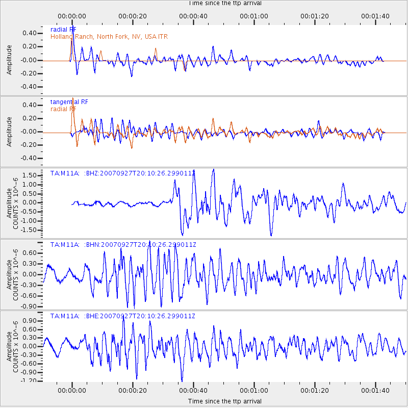
M11A Holland Ranch, North Fork, NV, USA - Earthquake Result Viewer

| Earthquake location: |
Southeast Of Loyalty Islands |
| Earthquake latitude/longitude: |
-21.1/169.3 |
| Earthquake time(UTC): |
2007/09/27 (270) 19:57:44 GMT |
| Earthquake Depth: |
9.0 km |
| Earthquake Magnitude: |
6.2 MB, 6.3 MS, 6.1 MW, 6.1 MW |
| Earthquake Catalog/Contributor: |
WHDF/NEIC |
|
| Network: |
TA USArray Transportable Network (new EarthScope stations) |
| Station: |
M11A Holland Ranch, North Fork, NV, USA |
| Lat/Lon: |
41.43 N/115.79 W |
| Elevation: |
1849 m |
|
| Distance: |
93.1 deg |
| Az: |
46.645 deg |
| Baz: |
244.542 deg |
| Ray Param: |
0.04133615 |
| Estimated Moho Depth: |
68.0 km |
| Estimated Crust Vp/Vs: |
1.60 |
| Assumed Crust Vp: |
6.276 km/s |
| Estimated Crust Vs: |
3.922 km/s |
| Estimated Crust Poisson's Ratio: |
0.18 |
|
| Radial Match: |
83.0827 % |
| Radial Bump: |
400 |
| Transverse Match: |
76.379776 % |
| Transverse Bump: |
400 |
| SOD ConfigId: |
2564 |
| Insert Time: |
2010-03-05 22:47:34.335 +0000 |
| GWidth: |
2.5 |
| Max Bumps: |
400 |
| Tol: |
0.001 |
|
Signal To Noise
| Channel | StoN | STA | LTA |
| TA:M11A: :BHN:20070927T20:10:26.299011Z | 0.81301993 | 1.5435936E-7 | 1.8985926E-7 |
| TA:M11A: :BHE:20070927T20:10:26.299011Z | 1.038729 | 1.8909608E-7 | 1.8204567E-7 |
| TA:M11A: :BHZ:20070927T20:10:26.299011Z | 5.543402 | 4.5113515E-7 | 8.138236E-8 |
| Arrivals |
| Ps | 6.6 SECOND |
| PpPs | 28 SECOND |
| PsPs/PpSs | 34 SECOND |


