You are here: Home > Network List > TA - USArray Transportable Network (new EarthScope stations) Stations List
> Station H17A Grant Village (NPS), Yellowstone Nt. Park, WY, USA > Earthquake Result Viewer
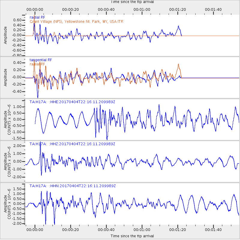
H17A Grant Village (NPS), Yellowstone Nt. Park, WY, USA - Earthquake Result Viewer
*The percent match for this event was below the threshold and hence no stack was calculated.
| Earthquake location: |
Andreanof Islands, Aleutian Is. |
| Earthquake latitude/longitude: |
51.3/-176.4 |
| Earthquake time(UTC): |
2017/04/04 (094) 22:08:40 GMT |
| Earthquake Depth: |
13 km |
| Earthquake Magnitude: |
5.5 Mww |
| Earthquake Catalog/Contributor: |
NEIC PDE/us |
|
| Network: |
TA USArray Transportable Network (new EarthScope stations) |
| Station: |
H17A Grant Village (NPS), Yellowstone Nt. Park, WY, USA |
| Lat/Lon: |
44.40 N/110.58 W |
| Elevation: |
2400 m |
|
| Distance: |
43.4 deg |
| Az: |
72.209 deg |
| Baz: |
303.444 deg |
| Ray Param: |
$rayparam |
*The percent match for this event was below the threshold and hence was not used in the summary stack. |
|
| Radial Match: |
41.170334 % |
| Radial Bump: |
400 |
| Transverse Match: |
61.321693 % |
| Transverse Bump: |
400 |
| SOD ConfigId: |
11737051 |
| Insert Time: |
2019-04-27 01:16:54.860 +0000 |
| GWidth: |
2.5 |
| Max Bumps: |
400 |
| Tol: |
0.001 |
|
Signal To Noise
| Channel | StoN | STA | LTA |
| TA:H17A: :HHZ:20170404T22:16:11.209989Z | 2.675778 | 8.5384374E-7 | 3.1910113E-7 |
| TA:H17A: :HHN:20170404T22:16:11.209989Z | 0.9928747 | 4.08138E-7 | 4.1106696E-7 |
| TA:H17A: :HHE:20170404T22:16:11.209989Z | 1.1528475 | 5.251656E-7 | 4.5553782E-7 |
| Arrivals |
| Ps | |
| PpPs | |
| PsPs/PpSs | |


