You are here: Home > Network List > TA - USArray Transportable Network (new EarthScope stations) Stations List
> Station M11A Holland Ranch, North Fork, NV, USA > Earthquake Result Viewer
M11A Holland Ranch, North Fork, NV, USA - Earthquake Result Viewer

| Earthquake location: |
Sakhalin, Russia |
| Earthquake latitude/longitude: |
46.5/141.9 |
| Earthquake time(UTC): |
2006/08/17 (229) 15:20:35 GMT |
| Earthquake Depth: |
17 km |
| Earthquake Magnitude: |
6.0 MB, 5.2 MS, 5.6 MW, 5.5 MW |
| Earthquake Catalog/Contributor: |
WHDF/NEIC |
|
| Network: |
TA USArray Transportable Network (new EarthScope stations) |
| Station: |
M11A Holland Ranch, North Fork, NV, USA |
| Lat/Lon: |
41.43 N/115.79 W |
| Elevation: |
1849 m |
|
| Distance: |
68.5 deg |
| Az: |
52.146 deg |
| Baz: |
313.546 deg |
| Ray Param: |
0.056243885 |
| Estimated Moho Depth: |
65.0 km |
| Estimated Crust Vp/Vs: |
1.71 |
| Assumed Crust Vp: |
6.276 km/s |
| Estimated Crust Vs: |
3.67 km/s |
| Estimated Crust Poisson's Ratio: |
0.24 |
|
| Radial Match: |
81.26111 % |
| Radial Bump: |
400 |
| Transverse Match: |
76.244606 % |
| Transverse Bump: |
400 |
| SOD ConfigId: |
2564 |
| Insert Time: |
2010-03-05 22:48:41.760 +0000 |
| GWidth: |
2.5 |
| Max Bumps: |
400 |
| Tol: |
0.001 |
|
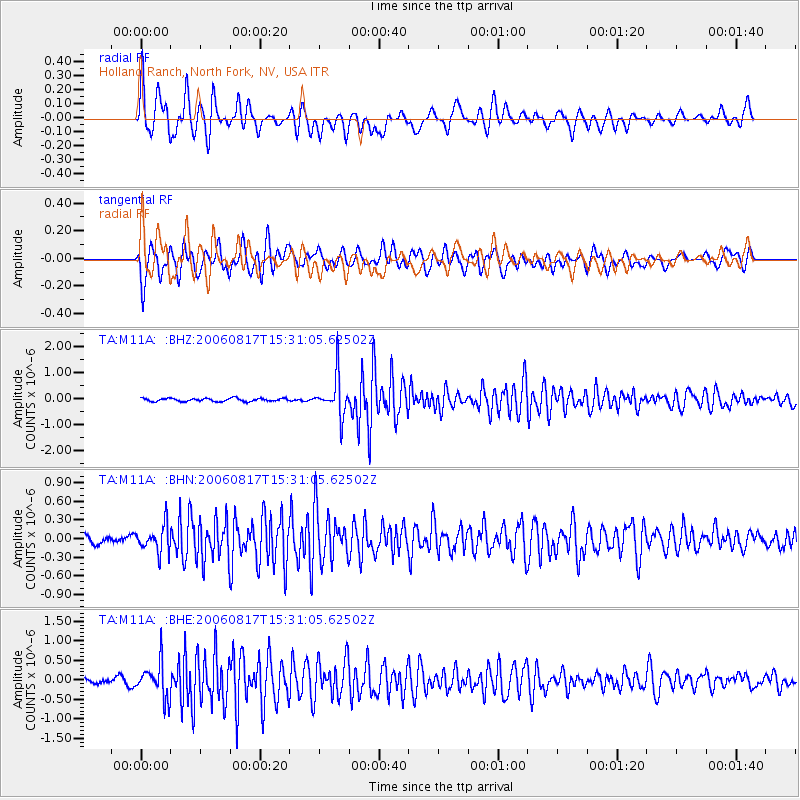
Signal To Noise
| Channel | StoN | STA | LTA |
| TA:M11A: :BHN:20060817T15:31:05.62502Z | 2.8577387 | 2.1565134E-7 | 7.546223E-8 |
| TA:M11A: :BHE:20060817T15:31:05.62502Z | 5.8274775 | 4.5043606E-7 | 7.7295205E-8 |
| TA:M11A: :BHZ:20060817T15:31:05.62502Z | 12.931428 | 7.6067835E-7 | 5.8824003E-8 |
| Arrivals |
| Ps | 7.6 SECOND |
| PpPs | 27 SECOND |
| PsPs/PpSs | 35 SECOND |


