You are here: Home > Network List > CI - Caltech Regional Seismic Network Stations List
> Station DAN Danby, California, USA > Earthquake Result Viewer
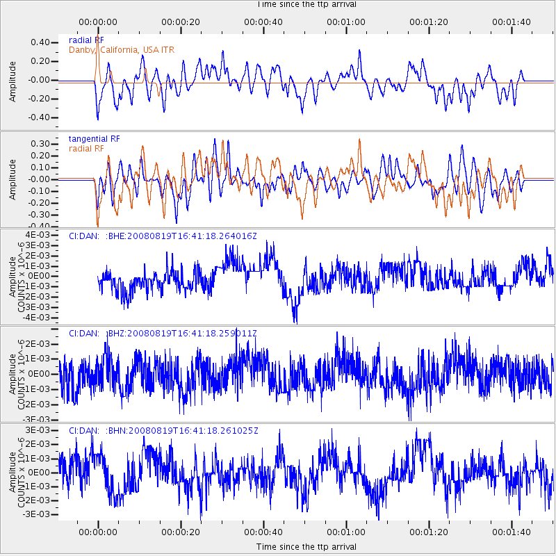
DAN Danby, California, USA - Earthquake Result Viewer
*The percent match for this event was below the threshold and hence no stack was calculated.
| Earthquake location: |
Tonga Islands |
| Earthquake latitude/longitude: |
-15.1/-173.5 |
| Earthquake time(UTC): |
2008/08/19 (232) 16:30:13 GMT |
| Earthquake Depth: |
8.0 km |
| Earthquake Magnitude: |
5.6 MB, 5.9 MS, 6.1 MW, 6.0 MW |
| Earthquake Catalog/Contributor: |
WHDF/NEIC |
|
| Network: |
CI Caltech Regional Seismic Network |
| Station: |
DAN Danby, California, USA |
| Lat/Lon: |
34.64 N/115.38 W |
| Elevation: |
398 m |
|
| Distance: |
74.1 deg |
| Az: |
46.716 deg |
| Baz: |
238.52 deg |
| Ray Param: |
$rayparam |
*The percent match for this event was below the threshold and hence was not used in the summary stack. |
|
| Radial Match: |
46.17346 % |
| Radial Bump: |
400 |
| Transverse Match: |
46.699203 % |
| Transverse Bump: |
400 |
| SOD ConfigId: |
2504 |
| Insert Time: |
2010-02-26 01:06:00.480 +0000 |
| GWidth: |
2.5 |
| Max Bumps: |
400 |
| Tol: |
0.001 |
|
Signal To Noise
| Channel | StoN | STA | LTA |
| CI:DAN: :BHZ:20080819T16:41:18.259011Z | 1.0786886 | 9.378838E-10 | 8.694666E-10 |
| CI:DAN: :BHN:20080819T16:41:18.261025Z | 1.1627605 | 1.3568051E-9 | 1.1668828E-9 |
| CI:DAN: :BHE:20080819T16:41:18.264016Z | 2.1647549 | 1.9329265E-9 | 8.9290775E-10 |
| Arrivals |
| Ps | |
| PpPs | |
| PsPs/PpSs | |


