You are here: Home > Network List > CI - Caltech Regional Seismic Network Stations List
> Station MPM Manuel Prospect Mine, California, USA > Earthquake Result Viewer
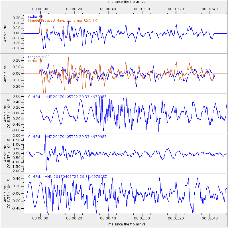
MPM Manuel Prospect Mine, California, USA - Earthquake Result Viewer
*The percent match for this event was below the threshold and hence no stack was calculated.
| Earthquake location: |
Vanuatu Islands |
| Earthquake latitude/longitude: |
-19.0/169.6 |
| Earthquake time(UTC): |
2017/04/05 (095) 22:17:42 GMT |
| Earthquake Depth: |
248 km |
| Earthquake Magnitude: |
5.6 Mww |
| Earthquake Catalog/Contributor: |
NEIC PDE/us |
|
| Network: |
CI Caltech Regional Seismic Network |
| Station: |
MPM Manuel Prospect Mine, California, USA |
| Lat/Lon: |
36.06 N/117.49 W |
| Elevation: |
185 m |
|
| Distance: |
88.0 deg |
| Az: |
50.814 deg |
| Baz: |
244.844 deg |
| Ray Param: |
$rayparam |
*The percent match for this event was below the threshold and hence was not used in the summary stack. |
|
| Radial Match: |
49.9445 % |
| Radial Bump: |
400 |
| Transverse Match: |
55.003525 % |
| Transverse Bump: |
400 |
| SOD ConfigId: |
11737051 |
| Insert Time: |
2019-04-27 01:30:38.420 +0000 |
| GWidth: |
2.5 |
| Max Bumps: |
400 |
| Tol: |
0.001 |
|
Signal To Noise
| Channel | StoN | STA | LTA |
| CI:MPM: :HHZ:20170405T22:29:33.497998Z | 5.807127 | 8.1257207E-7 | 1.399267E-7 |
| CI:MPM: :HHN:20170405T22:29:33.497998Z | 1.9736588 | 2.5057432E-7 | 1.2695929E-7 |
| CI:MPM: :HHE:20170405T22:29:33.497998Z | 1.0872478 | 2.2216243E-7 | 2.0433467E-7 |
| Arrivals |
| Ps | |
| PpPs | |
| PsPs/PpSs | |


