You are here: Home > Network List > TA - USArray Transportable Network (new EarthScope stations) Stations List
> Station M11A Holland Ranch, North Fork, NV, USA > Earthquake Result Viewer
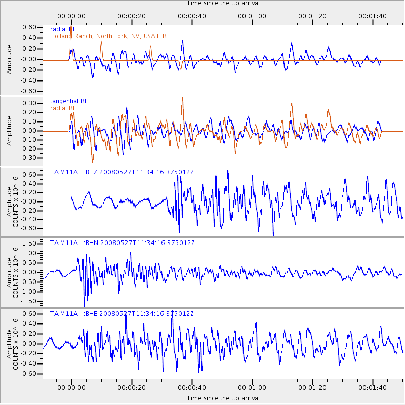
M11A Holland Ranch, North Fork, NV, USA - Earthquake Result Viewer
*The percent match for this event was below the threshold and hence no stack was calculated.
| Earthquake location: |
Near Coast Of Guatemala |
| Earthquake latitude/longitude: |
13.6/-91.0 |
| Earthquake time(UTC): |
2008/05/27 (148) 11:27:55 GMT |
| Earthquake Depth: |
26 km |
| Earthquake Magnitude: |
5.7 MW, 5.1 MS, 5.3 MB, 5.6 MW |
| Earthquake Catalog/Contributor: |
WHDF/NEIC |
|
| Network: |
TA USArray Transportable Network (new EarthScope stations) |
| Station: |
M11A Holland Ranch, North Fork, NV, USA |
| Lat/Lon: |
41.43 N/115.79 W |
| Elevation: |
1849 m |
|
| Distance: |
35.1 deg |
| Az: |
326.786 deg |
| Baz: |
134.907 deg |
| Ray Param: |
$rayparam |
*The percent match for this event was below the threshold and hence was not used in the summary stack. |
|
| Radial Match: |
65.17147 % |
| Radial Bump: |
400 |
| Transverse Match: |
70.717606 % |
| Transverse Bump: |
400 |
| SOD ConfigId: |
2504 |
| Insert Time: |
2010-03-05 22:50:33.387 +0000 |
| GWidth: |
2.5 |
| Max Bumps: |
400 |
| Tol: |
0.001 |
|
Signal To Noise
| Channel | StoN | STA | LTA |
| TA:M11A: :BHN:20080527T11:34:16.375012Z | 4.4523554 | 5.397223E-7 | 1.2122176E-7 |
| TA:M11A: :BHE:20080527T11:34:16.375012Z | 1.02636 | 1.122378E-7 | 1.0935519E-7 |
| TA:M11A: :BHZ:20080527T11:34:16.375012Z | 2.051826 | 1.803806E-7 | 8.7912234E-8 |
| Arrivals |
| Ps | |
| PpPs | |
| PsPs/PpSs | |


