You are here: Home > Network List > TA - USArray Transportable Network (new EarthScope stations) Stations List
> Station M11A Holland Ranch, North Fork, NV, USA > Earthquake Result Viewer
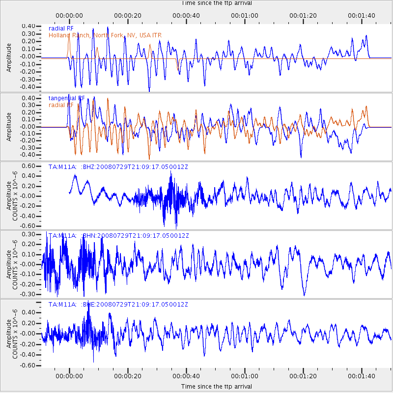
M11A Holland Ranch, North Fork, NV, USA - Earthquake Result Viewer
*The percent match for this event was below the threshold and hence no stack was calculated.
| Earthquake location: |
Southern East Pacific Rise |
| Earthquake latitude/longitude: |
-54.7/-118.8 |
| Earthquake time(UTC): |
2008/07/29 (211) 20:56:22 GMT |
| Earthquake Depth: |
10 km |
| Earthquake Magnitude: |
5.5 MB, 5.4 MS, 5.8 MW, 5.7 MW |
| Earthquake Catalog/Contributor: |
WHDF/NEIC |
|
| Network: |
TA USArray Transportable Network (new EarthScope stations) |
| Station: |
M11A Holland Ranch, North Fork, NV, USA |
| Lat/Lon: |
41.43 N/115.79 W |
| Elevation: |
1849 m |
|
| Distance: |
95.8 deg |
| Az: |
2.261 deg |
| Baz: |
181.744 deg |
| Ray Param: |
$rayparam |
*The percent match for this event was below the threshold and hence was not used in the summary stack. |
|
| Radial Match: |
51.707058 % |
| Radial Bump: |
400 |
| Transverse Match: |
45.88814 % |
| Transverse Bump: |
400 |
| SOD ConfigId: |
2504 |
| Insert Time: |
2010-03-05 22:50:42.741 +0000 |
| GWidth: |
2.5 |
| Max Bumps: |
400 |
| Tol: |
0.001 |
|
Signal To Noise
| Channel | StoN | STA | LTA |
| TA:M11A: :BHN:20080729T21:09:17.050012Z | 1.8434311 | 1.325709E-7 | 7.19153E-8 |
| TA:M11A: :BHE:20080729T21:09:17.050012Z | 1.2078446 | 1.11341336E-7 | 9.2181835E-8 |
| TA:M11A: :BHZ:20080729T21:09:17.050012Z | 1.514463 | 2.1458582E-7 | 1.4169105E-7 |
| Arrivals |
| Ps | |
| PpPs | |
| PsPs/PpSs | |


