You are here: Home > Network List > TA - USArray Transportable Network (new EarthScope stations) Stations List
> Station R22A Saguache, Gunnison, CO, USA > Earthquake Result Viewer
R22A Saguache, Gunnison, CO, USA - Earthquake Result Viewer

| Earthquake location: |
Andreanof Islands, Aleutian Is. |
| Earthquake latitude/longitude: |
52.2/-175.7 |
| Earthquake time(UTC): |
2008/08/07 (220) 18:30:03 GMT |
| Earthquake Depth: |
12 km |
| Earthquake Magnitude: |
5.6 MB, 5.5 MS, 5.8 MW, 5.8 MW |
| Earthquake Catalog/Contributor: |
WHDF/NEIC |
|
| Network: |
TA USArray Transportable Network (new EarthScope stations) |
| Station: |
R22A Saguache, Gunnison, CO, USA |
| Lat/Lon: |
38.23 N/106.76 W |
| Elevation: |
2773 m |
|
| Distance: |
48.7 deg |
| Az: |
78.021 deg |
| Baz: |
310.124 deg |
| Ray Param: |
0.06919208 |
| Estimated Moho Depth: |
34.75 km |
| Estimated Crust Vp/Vs: |
2.08 |
| Assumed Crust Vp: |
6.306 km/s |
| Estimated Crust Vs: |
3.028 km/s |
| Estimated Crust Poisson's Ratio: |
0.35 |
|
| Radial Match: |
85.06173 % |
| Radial Bump: |
400 |
| Transverse Match: |
72.78251 % |
| Transverse Bump: |
400 |
| SOD ConfigId: |
2504 |
| Insert Time: |
2010-03-05 22:51:22.982 +0000 |
| GWidth: |
2.5 |
| Max Bumps: |
400 |
| Tol: |
0.001 |
|
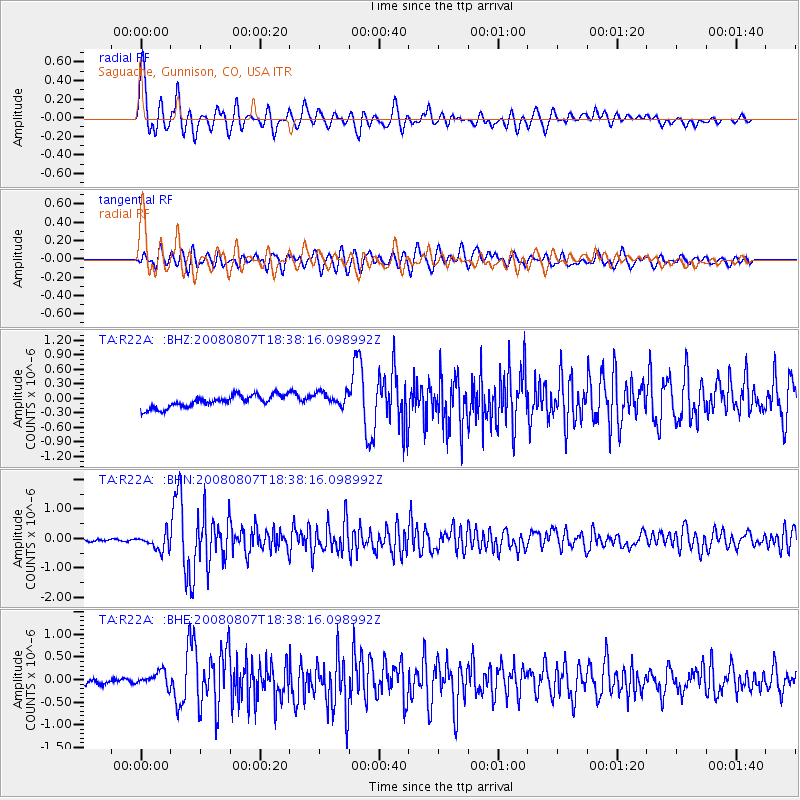
Signal To Noise
| Channel | StoN | STA | LTA |
| TA:R22A: :BHN:20080807T18:38:16.098992Z | 6.5158014 | 2.7944984E-7 | 4.2888022E-8 |
| TA:R22A: :BHE:20080807T18:38:16.098992Z | 2.8469253 | 1.8548384E-7 | 6.5152335E-8 |
| TA:R22A: :BHZ:20080807T18:38:16.098992Z | 1.2228155 | 1.5269357E-7 | 1.2487048E-7 |
| Arrivals |
| Ps | 6.3 SECOND |
| PpPs | 16 SECOND |
| PsPs/PpSs | 22 SECOND |


