You are here: Home > Network List > TA - USArray Transportable Network (new EarthScope stations) Stations List
> Station F26K Sheenjek River, AK, USA > Earthquake Result Viewer
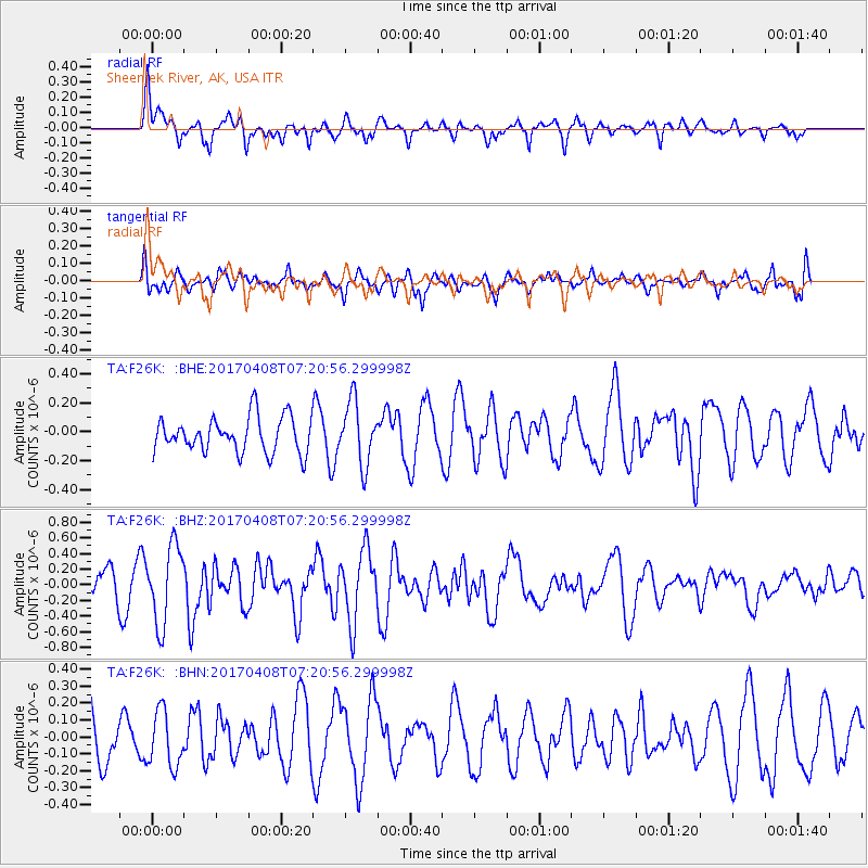
F26K Sheenjek River, AK, USA - Earthquake Result Viewer
*The percent match for this event was below the threshold and hence no stack was calculated.
| Earthquake location: |
Mindoro, Philippines |
| Earthquake latitude/longitude: |
13.7/120.9 |
| Earthquake time(UTC): |
2017/04/08 (098) 07:09:27 GMT |
| Earthquake Depth: |
43 km |
| Earthquake Magnitude: |
5.9 Mww |
| Earthquake Catalog/Contributor: |
NEIC PDE/us |
|
| Network: |
TA USArray Transportable Network (new EarthScope stations) |
| Station: |
F26K Sheenjek River, AK, USA |
| Lat/Lon: |
67.69 N/144.15 W |
| Elevation: |
683 m |
|
| Distance: |
79.3 deg |
| Az: |
22.773 deg |
| Baz: |
279.793 deg |
| Ray Param: |
$rayparam |
*The percent match for this event was below the threshold and hence was not used in the summary stack. |
|
| Radial Match: |
74.72319 % |
| Radial Bump: |
400 |
| Transverse Match: |
57.630657 % |
| Transverse Bump: |
400 |
| SOD ConfigId: |
11737051 |
| Insert Time: |
2019-04-27 01:44:24.359 +0000 |
| GWidth: |
2.5 |
| Max Bumps: |
400 |
| Tol: |
0.001 |
|
Signal To Noise
| Channel | StoN | STA | LTA |
| TA:F26K: :BHZ:20170408T07:20:56.299998Z | 3.4136605 | 4.9563334E-7 | 1.4519117E-7 |
| TA:F26K: :BHN:20170408T07:20:56.299998Z | 1.1096437 | 1.6342393E-7 | 1.4727604E-7 |
| TA:F26K: :BHE:20170408T07:20:56.299998Z | 1.6541015 | 2.167736E-7 | 1.3105218E-7 |
| Arrivals |
| Ps | |
| PpPs | |
| PsPs/PpSs | |


