You are here: Home > Network List > AK - Alaska Regional Network Stations List
> Station CUT Chulitna, AK, USA > Earthquake Result Viewer
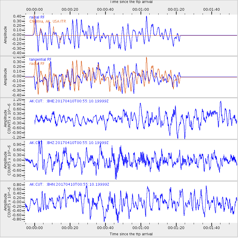
CUT Chulitna, AK, USA - Earthquake Result Viewer
*The percent match for this event was below the threshold and hence no stack was calculated.
| Earthquake location: |
Philippine Islands Region |
| Earthquake latitude/longitude: |
13.0/125.4 |
| Earthquake time(UTC): |
2017/04/10 (100) 00:43:54 GMT |
| Earthquake Depth: |
8.2 km |
| Earthquake Magnitude: |
5.6 Mww |
| Earthquake Catalog/Contributor: |
NEIC PDE/us |
|
| Network: |
AK Alaska Regional Network |
| Station: |
CUT Chulitna, AK, USA |
| Lat/Lon: |
62.41 N/150.26 W |
| Elevation: |
574 m |
|
| Distance: |
76.0 deg |
| Az: |
28.534 deg |
| Baz: |
271.166 deg |
| Ray Param: |
$rayparam |
*The percent match for this event was below the threshold and hence was not used in the summary stack. |
|
| Radial Match: |
58.0423 % |
| Radial Bump: |
400 |
| Transverse Match: |
48.09629 % |
| Transverse Bump: |
400 |
| SOD ConfigId: |
11737051 |
| Insert Time: |
2019-04-27 01:50:15.639 +0000 |
| GWidth: |
2.5 |
| Max Bumps: |
400 |
| Tol: |
0.001 |
|
Signal To Noise
| Channel | StoN | STA | LTA |
| AK:CUT: :BHZ:20170410T00:55:10.19999Z | 4.285701 | 5.835317E-7 | 1.3615782E-7 |
| AK:CUT: :BHN:20170410T00:55:10.19999Z | 0.8454109 | 2.445111E-7 | 2.8922165E-7 |
| AK:CUT: :BHE:20170410T00:55:10.19999Z | 0.83197194 | 1.5828142E-7 | 1.9024851E-7 |
| Arrivals |
| Ps | |
| PpPs | |
| PsPs/PpSs | |


