You are here: Home > Network List > CN - Canadian National Seismograph Network Stations List
> Station INK INUVIK, NT > Earthquake Result Viewer
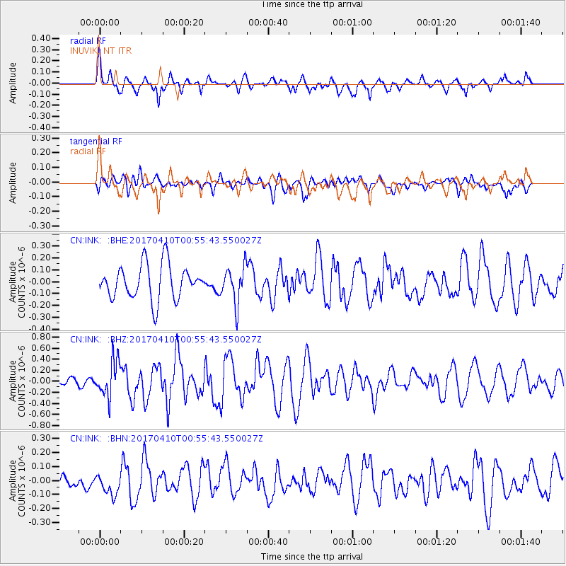
INK INUVIK, NT - Earthquake Result Viewer
*The percent match for this event was below the threshold and hence no stack was calculated.
| Earthquake location: |
Philippine Islands Region |
| Earthquake latitude/longitude: |
13.0/125.4 |
| Earthquake time(UTC): |
2017/04/10 (100) 00:43:54 GMT |
| Earthquake Depth: |
8.2 km |
| Earthquake Magnitude: |
5.6 Mww |
| Earthquake Catalog/Contributor: |
NEIC PDE/us |
|
| Network: |
CN Canadian National Seismograph Network |
| Station: |
INK INUVIK, NT |
| Lat/Lon: |
68.31 N/133.53 W |
| Elevation: |
44 m |
|
| Distance: |
82.1 deg |
| Az: |
21.614 deg |
| Baz: |
285.077 deg |
| Ray Param: |
$rayparam |
*The percent match for this event was below the threshold and hence was not used in the summary stack. |
|
| Radial Match: |
69.60567 % |
| Radial Bump: |
400 |
| Transverse Match: |
50.512676 % |
| Transverse Bump: |
400 |
| SOD ConfigId: |
11737051 |
| Insert Time: |
2019-04-27 01:51:41.757 +0000 |
| GWidth: |
2.5 |
| Max Bumps: |
400 |
| Tol: |
0.001 |
|
Signal To Noise
| Channel | StoN | STA | LTA |
| CN:INK: :BHZ:20170410T00:55:43.550027Z | 2.5431798 | 3.3650946E-7 | 1.3231839E-7 |
| CN:INK: :BHN:20170410T00:55:43.550027Z | 0.67138284 | 7.79869E-8 | 1.1615861E-7 |
| CN:INK: :BHE:20170410T00:55:43.550027Z | 1.0946424 | 1.6068783E-7 | 1.4679482E-7 |
| Arrivals |
| Ps | |
| PpPs | |
| PsPs/PpSs | |


