You are here: Home > Network List > TA - USArray Transportable Network (new EarthScope stations) Stations List
> Station R22A Saguache, Gunnison, CO, USA > Earthquake Result Viewer
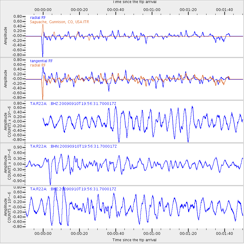
R22A Saguache, Gunnison, CO, USA - Earthquake Result Viewer
*The percent match for this event was below the threshold and hence no stack was calculated.
| Earthquake location: |
Easter Island Region |
| Earthquake latitude/longitude: |
-29.9/-111.8 |
| Earthquake time(UTC): |
2009/09/10 (253) 19:46:03 GMT |
| Earthquake Depth: |
10 km |
| Earthquake Magnitude: |
5.5 MW, 5.4 MB |
| Earthquake Catalog/Contributor: |
WHDF/NEIC |
|
| Network: |
TA USArray Transportable Network (new EarthScope stations) |
| Station: |
R22A Saguache, Gunnison, CO, USA |
| Lat/Lon: |
38.23 N/106.76 W |
| Elevation: |
2773 m |
|
| Distance: |
68.0 deg |
| Az: |
4.304 deg |
| Baz: |
184.745 deg |
| Ray Param: |
$rayparam |
*The percent match for this event was below the threshold and hence was not used in the summary stack. |
|
| Radial Match: |
50.81923 % |
| Radial Bump: |
400 |
| Transverse Match: |
65.97367 % |
| Transverse Bump: |
397 |
| SOD ConfigId: |
2622 |
| Insert Time: |
2010-03-05 22:53:12.869 +0000 |
| GWidth: |
2.5 |
| Max Bumps: |
400 |
| Tol: |
0.001 |
|
Signal To Noise
| Channel | StoN | STA | LTA |
| TA:R22A: :BHN:20090910T19:56:31.700017Z | 3.9165726 | 4.0488527E-7 | 1.0337744E-7 |
| TA:R22A: :BHE:20090910T19:56:31.700017Z | 1.4969889 | 3.273075E-7 | 2.1864389E-7 |
| TA:R22A: :BHZ:20090910T19:56:31.700017Z | 0.8752104 | 1.6487411E-7 | 1.8838226E-7 |
| Arrivals |
| Ps | |
| PpPs | |
| PsPs/PpSs | |


