You are here: Home > Network List > TA - USArray Transportable Network (new EarthScope stations) Stations List
> Station F26K Sheenjek River, AK, USA > Earthquake Result Viewer
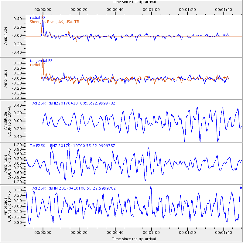
F26K Sheenjek River, AK, USA - Earthquake Result Viewer
*The percent match for this event was below the threshold and hence no stack was calculated.
| Earthquake location: |
Philippine Islands Region |
| Earthquake latitude/longitude: |
13.0/125.4 |
| Earthquake time(UTC): |
2017/04/10 (100) 00:43:54 GMT |
| Earthquake Depth: |
8.2 km |
| Earthquake Magnitude: |
5.6 Mww |
| Earthquake Catalog/Contributor: |
NEIC PDE/us |
|
| Network: |
TA USArray Transportable Network (new EarthScope stations) |
| Station: |
F26K Sheenjek River, AK, USA |
| Lat/Lon: |
67.69 N/144.15 W |
| Elevation: |
683 m |
|
| Distance: |
78.2 deg |
| Az: |
22.948 deg |
| Baz: |
275.464 deg |
| Ray Param: |
$rayparam |
*The percent match for this event was below the threshold and hence was not used in the summary stack. |
|
| Radial Match: |
66.3412 % |
| Radial Bump: |
327 |
| Transverse Match: |
56.35196 % |
| Transverse Bump: |
400 |
| SOD ConfigId: |
11737051 |
| Insert Time: |
2019-04-27 01:55:19.345 +0000 |
| GWidth: |
2.5 |
| Max Bumps: |
400 |
| Tol: |
0.001 |
|
Signal To Noise
| Channel | StoN | STA | LTA |
| TA:F26K: :BHZ:20170410T00:55:22.999978Z | 2.6348212 | 4.487058E-7 | 1.7029839E-7 |
| TA:F26K: :BHN:20170410T00:55:22.999978Z | 0.8273744 | 9.884338E-8 | 1.1946634E-7 |
| TA:F26K: :BHE:20170410T00:55:22.999978Z | 0.97356635 | 1.08652024E-7 | 1.1160208E-7 |
| Arrivals |
| Ps | |
| PpPs | |
| PsPs/PpSs | |


