You are here: Home > Network List > TA - USArray Transportable Network (new EarthScope stations) Stations List
> Station R22A Saguache, Gunnison, CO, USA > Earthquake Result Viewer
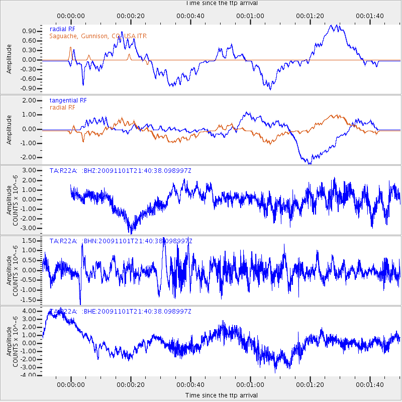
R22A Saguache, Gunnison, CO, USA - Earthquake Result Viewer
*The percent match for this event was below the threshold and hence no stack was calculated.
| Earthquake location: |
Tonga Islands |
| Earthquake latitude/longitude: |
-15.5/-173.8 |
| Earthquake time(UTC): |
2009/11/01 (305) 21:28:58 GMT |
| Earthquake Depth: |
105 km |
| Earthquake Magnitude: |
5.8 MW, 5.4 MB, 5.8 MW |
| Earthquake Catalog/Contributor: |
WHDF/NEIC |
|
| Network: |
TA USArray Transportable Network (new EarthScope stations) |
| Station: |
R22A Saguache, Gunnison, CO, USA |
| Lat/Lon: |
38.23 N/106.76 W |
| Elevation: |
2773 m |
|
| Distance: |
82.4 deg |
| Az: |
47.007 deg |
| Baz: |
243.555 deg |
| Ray Param: |
$rayparam |
*The percent match for this event was below the threshold and hence was not used in the summary stack. |
|
| Radial Match: |
38.567974 % |
| Radial Bump: |
400 |
| Transverse Match: |
25.421383 % |
| Transverse Bump: |
400 |
| SOD ConfigId: |
2622 |
| Insert Time: |
2010-03-05 22:53:22.536 +0000 |
| GWidth: |
2.5 |
| Max Bumps: |
400 |
| Tol: |
0.001 |
|
Signal To Noise
| Channel | StoN | STA | LTA |
| TA:R22A: :BHN:20091101T21:40:38.098997Z | 1.9011073 | 5.8671145E-7 | 3.0861563E-7 |
| TA:R22A: :BHE:20091101T21:40:38.098997Z | 1.445384 | 3.783477E-6 | 2.6176276E-6 |
| TA:R22A: :BHZ:20091101T21:40:38.098997Z | 0.84841794 | 1.0287847E-6 | 1.2125919E-6 |
| Arrivals |
| Ps | |
| PpPs | |
| PsPs/PpSs | |


