You are here: Home > Network List > TA - USArray Transportable Network (new EarthScope stations) Stations List
> Station L20K Farewell, AK, USA > Earthquake Result Viewer
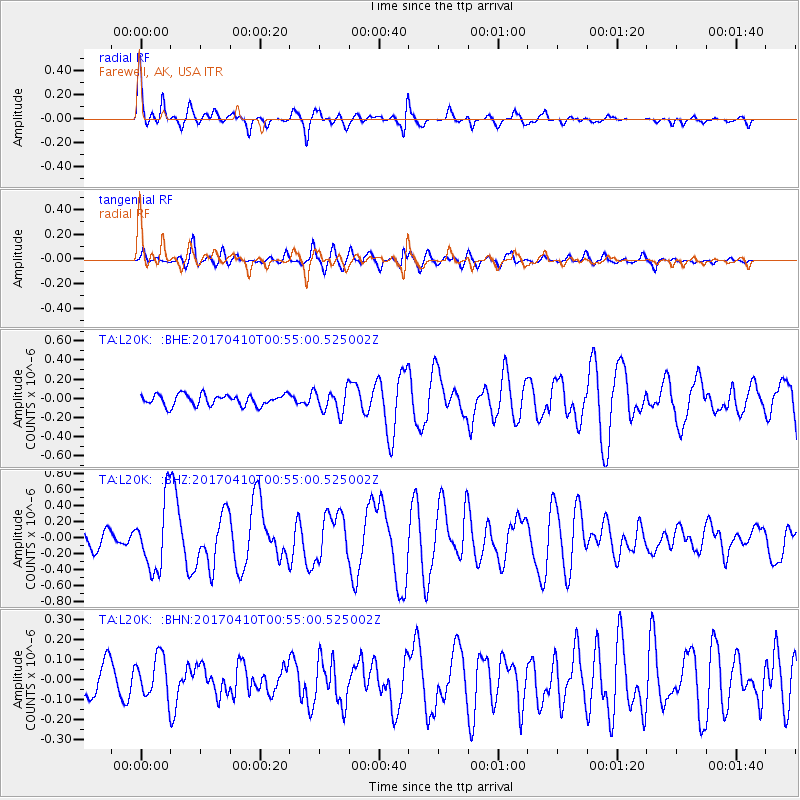
L20K Farewell, AK, USA - Earthquake Result Viewer
*The percent match for this event was below the threshold and hence no stack was calculated.
| Earthquake location: |
Philippine Islands Region |
| Earthquake latitude/longitude: |
13.0/125.4 |
| Earthquake time(UTC): |
2017/04/10 (100) 00:43:54 GMT |
| Earthquake Depth: |
8.2 km |
| Earthquake Magnitude: |
5.6 Mww |
| Earthquake Catalog/Contributor: |
NEIC PDE/us |
|
| Network: |
TA USArray Transportable Network (new EarthScope stations) |
| Station: |
L20K Farewell, AK, USA |
| Lat/Lon: |
62.48 N/153.88 W |
| Elevation: |
673 m |
|
| Distance: |
74.3 deg |
| Az: |
28.445 deg |
| Baz: |
267.941 deg |
| Ray Param: |
$rayparam |
*The percent match for this event was below the threshold and hence was not used in the summary stack. |
|
| Radial Match: |
77.565994 % |
| Radial Bump: |
372 |
| Transverse Match: |
62.39732 % |
| Transverse Bump: |
400 |
| SOD ConfigId: |
11737051 |
| Insert Time: |
2019-04-27 01:55:43.245 +0000 |
| GWidth: |
2.5 |
| Max Bumps: |
400 |
| Tol: |
0.001 |
|
Signal To Noise
| Channel | StoN | STA | LTA |
| TA:L20K: :BHZ:20170410T00:55:00.525002Z | 3.4543977 | 4.269947E-7 | 1.2360901E-7 |
| TA:L20K: :BHN:20170410T00:55:00.525002Z | 1.0123283 | 1.0286558E-7 | 1.0161286E-7 |
| TA:L20K: :BHE:20170410T00:55:00.525002Z | 2.1451912 | 1.2533957E-7 | 5.8428157E-8 |
| Arrivals |
| Ps | |
| PpPs | |
| PsPs/PpSs | |


