You are here: Home > Network List > AV - Alaska Volcano Observatory Stations List
> Station MAPS Pakushin Southeast, Makushin Volcano, Alaska > Earthquake Result Viewer
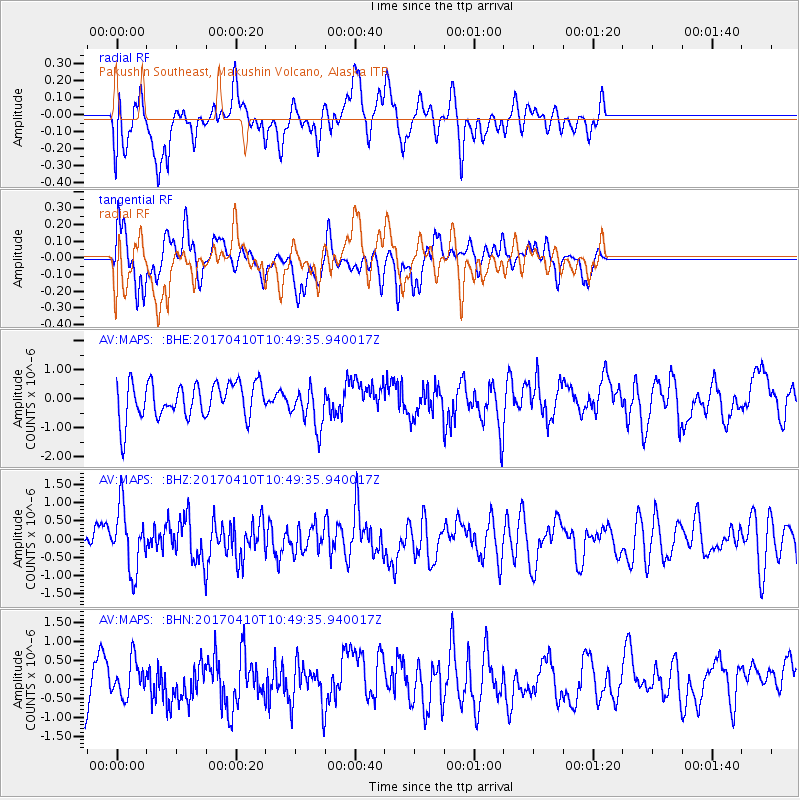
MAPS Pakushin Southeast, Makushin Volcano, Alaska - Earthquake Result Viewer
*The percent match for this event was below the threshold and hence no stack was calculated.
| Earthquake location: |
Philippine Islands Region |
| Earthquake latitude/longitude: |
5.7/127.2 |
| Earthquake time(UTC): |
2017/04/10 (100) 10:38:48 GMT |
| Earthquake Depth: |
13 km |
| Earthquake Magnitude: |
5.8 Mww |
| Earthquake Catalog/Contributor: |
NEIC PDE/us |
|
| Network: |
AV Alaska Volcano Observatory |
| Station: |
MAPS Pakushin Southeast, Makushin Volcano, Alaska |
| Lat/Lon: |
53.81 N/166.94 W |
| Elevation: |
333 m |
|
| Distance: |
71.3 deg |
| Az: |
34.847 deg |
| Baz: |
253.485 deg |
| Ray Param: |
$rayparam |
*The percent match for this event was below the threshold and hence was not used in the summary stack. |
|
| Radial Match: |
57.29849 % |
| Radial Bump: |
400 |
| Transverse Match: |
56.20323 % |
| Transverse Bump: |
400 |
| SOD ConfigId: |
11737051 |
| Insert Time: |
2019-04-27 01:59:39.347 +0000 |
| GWidth: |
2.5 |
| Max Bumps: |
400 |
| Tol: |
0.001 |
|
Signal To Noise
| Channel | StoN | STA | LTA |
| AV:MAPS: :BHZ:20170410T10:49:35.940017Z | 2.2244384 | 8.487361E-7 | 3.8155073E-7 |
| AV:MAPS: :BHN:20170410T10:49:35.940017Z | 0.9586429 | 4.6536664E-7 | 4.854432E-7 |
| AV:MAPS: :BHE:20170410T10:49:35.940017Z | 1.1627302 | 7.1739254E-7 | 6.1698967E-7 |
| Arrivals |
| Ps | |
| PpPs | |
| PsPs/PpSs | |


