You are here: Home > Network List > TJ - Tajikistan National Seismic Network Stations List
> Station GARM Garm, Tajikistan > Earthquake Result Viewer
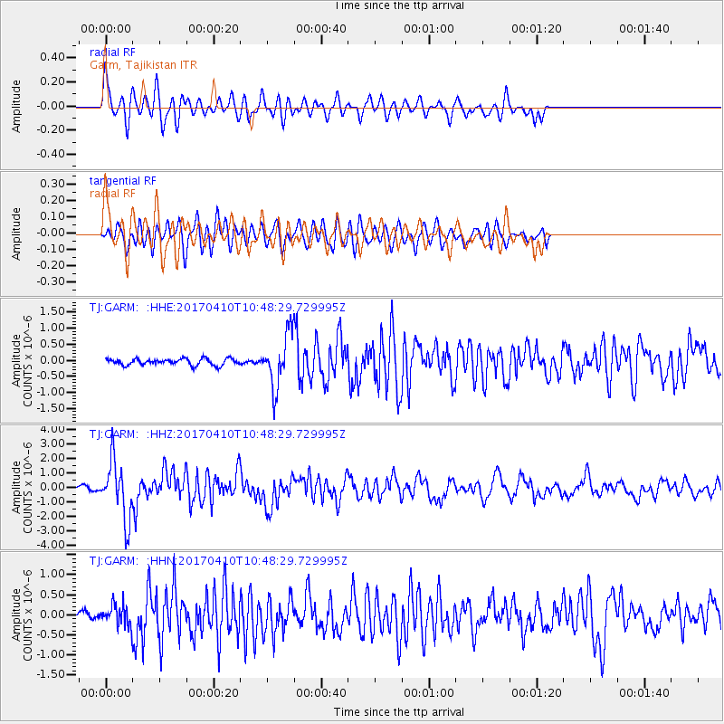
GARM Garm, Tajikistan - Earthquake Result Viewer
*The percent match for this event was below the threshold and hence no stack was calculated.
| Earthquake location: |
Philippine Islands Region |
| Earthquake latitude/longitude: |
5.7/127.2 |
| Earthquake time(UTC): |
2017/04/10 (100) 10:38:48 GMT |
| Earthquake Depth: |
13 km |
| Earthquake Magnitude: |
5.8 Mww |
| Earthquake Catalog/Contributor: |
NEIC PDE/us |
|
| Network: |
TJ Tajikistan National Seismic Network |
| Station: |
GARM Garm, Tajikistan |
| Lat/Lon: |
39.00 N/70.32 E |
| Elevation: |
1305 m |
|
| Distance: |
61.0 deg |
| Az: |
311.716 deg |
| Baz: |
107.578 deg |
| Ray Param: |
$rayparam |
*The percent match for this event was below the threshold and hence was not used in the summary stack. |
|
| Radial Match: |
72.62038 % |
| Radial Bump: |
400 |
| Transverse Match: |
71.16109 % |
| Transverse Bump: |
400 |
| SOD ConfigId: |
11737051 |
| Insert Time: |
2019-04-27 02:02:35.916 +0000 |
| GWidth: |
2.5 |
| Max Bumps: |
400 |
| Tol: |
0.001 |
|
Signal To Noise
| Channel | StoN | STA | LTA |
| TJ:GARM: :HHZ:20170410T10:48:29.729995Z | 15.953231 | 2.0171906E-6 | 1.2644402E-7 |
| TJ:GARM: :HHN:20170410T10:48:29.729995Z | 2.7554133 | 2.5379052E-7 | 9.2106156E-8 |
| TJ:GARM: :HHE:20170410T10:48:29.729995Z | 8.117913 | 8.148202E-7 | 1.00373114E-7 |
| Arrivals |
| Ps | |
| PpPs | |
| PsPs/PpSs | |


