You are here: Home > Network List > TA - USArray Transportable Network (new EarthScope stations) Stations List
> Station I23K Minto, Yukon-Koyukuk, AK, USA > Earthquake Result Viewer
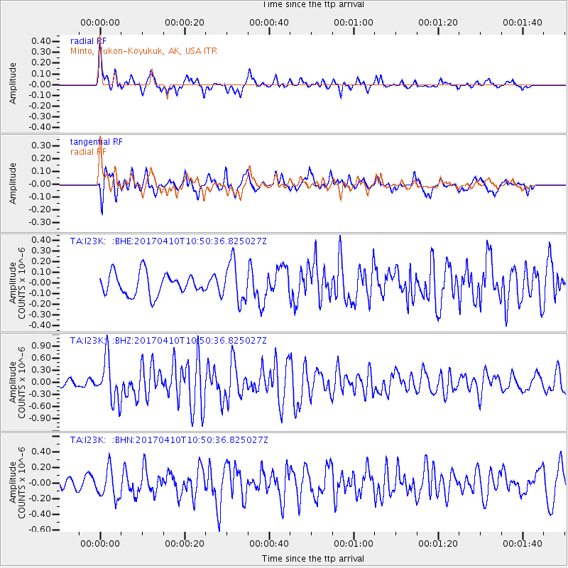
I23K Minto, Yukon-Koyukuk, AK, USA - Earthquake Result Viewer
*The percent match for this event was below the threshold and hence no stack was calculated.
| Earthquake location: |
Philippine Islands Region |
| Earthquake latitude/longitude: |
5.7/127.2 |
| Earthquake time(UTC): |
2017/04/10 (100) 10:38:48 GMT |
| Earthquake Depth: |
13 km |
| Earthquake Magnitude: |
5.8 Mww |
| Earthquake Catalog/Contributor: |
NEIC PDE/us |
|
| Network: |
TA USArray Transportable Network (new EarthScope stations) |
| Station: |
I23K Minto, Yukon-Koyukuk, AK, USA |
| Lat/Lon: |
65.15 N/149.36 W |
| Elevation: |
149 m |
|
| Distance: |
82.1 deg |
| Az: |
25.078 deg |
| Baz: |
266.447 deg |
| Ray Param: |
$rayparam |
*The percent match for this event was below the threshold and hence was not used in the summary stack. |
|
| Radial Match: |
68.14694 % |
| Radial Bump: |
400 |
| Transverse Match: |
70.7157 % |
| Transverse Bump: |
400 |
| SOD ConfigId: |
11737051 |
| Insert Time: |
2019-04-27 02:03:06.175 +0000 |
| GWidth: |
2.5 |
| Max Bumps: |
400 |
| Tol: |
0.001 |
|
Signal To Noise
| Channel | StoN | STA | LTA |
| TA:I23K: :BHZ:20170410T10:50:36.825027Z | 5.5552316 | 5.3853023E-7 | 9.694109E-8 |
| TA:I23K: :BHN:20170410T10:50:36.825027Z | 1.9933214 | 1.9198276E-7 | 9.6312995E-8 |
| TA:I23K: :BHE:20170410T10:50:36.825027Z | 1.8720722 | 1.8956612E-7 | 1.0126005E-7 |
| Arrivals |
| Ps | |
| PpPs | |
| PsPs/PpSs | |


