You are here: Home > Network List > TA - USArray Transportable Network (new EarthScope stations) Stations List
> Station O18K Koktuh Hills, AK, USA > Earthquake Result Viewer
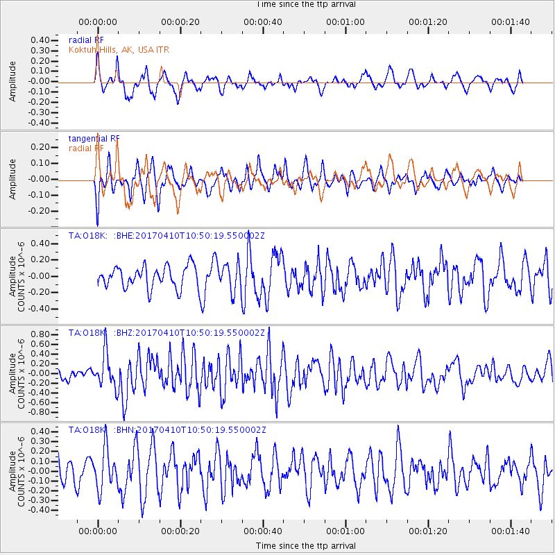
O18K Koktuh Hills, AK, USA - Earthquake Result Viewer
*The percent match for this event was below the threshold and hence no stack was calculated.
| Earthquake location: |
Philippine Islands Region |
| Earthquake latitude/longitude: |
5.7/127.2 |
| Earthquake time(UTC): |
2017/04/10 (100) 10:38:48 GMT |
| Earthquake Depth: |
13 km |
| Earthquake Magnitude: |
5.8 Mww |
| Earthquake Catalog/Contributor: |
NEIC PDE/us |
|
| Network: |
TA USArray Transportable Network (new EarthScope stations) |
| Station: |
O18K Koktuh Hills, AK, USA |
| Lat/Lon: |
59.85 N/155.21 W |
| Elevation: |
544 m |
|
| Distance: |
78.9 deg |
| Az: |
30.158 deg |
| Baz: |
262.1 deg |
| Ray Param: |
$rayparam |
*The percent match for this event was below the threshold and hence was not used in the summary stack. |
|
| Radial Match: |
53.72782 % |
| Radial Bump: |
325 |
| Transverse Match: |
57.409332 % |
| Transverse Bump: |
392 |
| SOD ConfigId: |
11737051 |
| Insert Time: |
2019-04-27 02:03:29.644 +0000 |
| GWidth: |
2.5 |
| Max Bumps: |
400 |
| Tol: |
0.001 |
|
Signal To Noise
| Channel | StoN | STA | LTA |
| TA:O18K: :BHZ:20170410T10:50:19.550002Z | 2.024441 | 3.6742964E-7 | 1.8149682E-7 |
| TA:O18K: :BHN:20170410T10:50:19.550002Z | 1.6288154 | 2.1014607E-7 | 1.2901774E-7 |
| TA:O18K: :BHE:20170410T10:50:19.550002Z | 1.2904143 | 1.7009582E-7 | 1.3181489E-7 |
| Arrivals |
| Ps | |
| PpPs | |
| PsPs/PpSs | |


