You are here: Home > Network List > CN - Canadian National Seismograph Network Stations List
> Station INK INUVIK, NT > Earthquake Result Viewer
INK INUVIK, NT - Earthquake Result Viewer
*The percent match for this event was below the threshold and hence no stack was calculated.
| Earthquake location: |
Philippine Islands Region |
| Earthquake latitude/longitude: |
5.7/127.1 |
| Earthquake time(UTC): |
2017/04/11 (101) 14:42:16 GMT |
| Earthquake Depth: |
9.6 km |
| Earthquake Magnitude: |
5.6 mb |
| Earthquake Catalog/Contributor: |
NEIC PDE/us |
|
| Network: |
CN Canadian National Seismograph Network |
| Station: |
INK INUVIK, NT |
| Lat/Lon: |
68.31 N/133.53 W |
| Elevation: |
44 m |
|
| Distance: |
88.2 deg |
| Az: |
21.53 deg |
| Baz: |
280.794 deg |
| Ray Param: |
$rayparam |
*The percent match for this event was below the threshold and hence was not used in the summary stack. |
|
| Radial Match: |
64.869675 % |
| Radial Bump: |
400 |
| Transverse Match: |
61.33685 % |
| Transverse Bump: |
400 |
| SOD ConfigId: |
11737051 |
| Insert Time: |
2019-04-27 02:06:59.516 +0000 |
| GWidth: |
2.5 |
| Max Bumps: |
400 |
| Tol: |
0.001 |
|
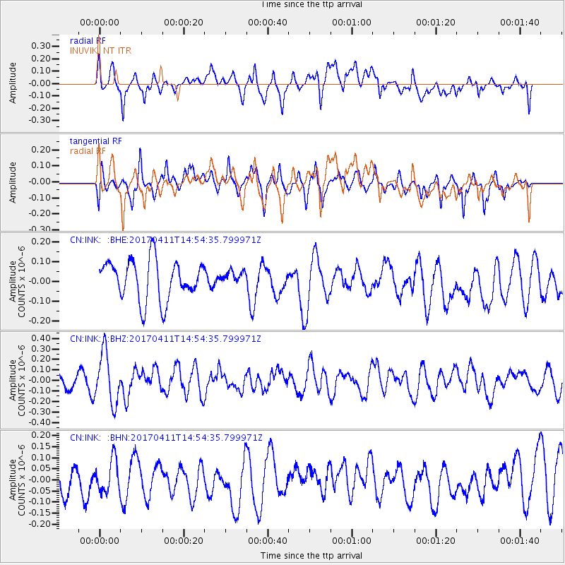
Signal To Noise
| Channel | StoN | STA | LTA |
| CN:INK: :BHZ:20170411T14:54:35.799971Z | 3.1195803 | 2.4424747E-7 | 7.8294974E-8 |
| CN:INK: :BHN:20170411T14:54:35.799971Z | 1.3325616 | 7.380749E-8 | 5.5387677E-8 |
| CN:INK: :BHE:20170411T14:54:35.799971Z | 0.3259316 | 3.2932945E-8 | 1.0104251E-7 |
| Arrivals |
| Ps | |
| PpPs | |
| PsPs/PpSs | |


