You are here: Home > Network List > US - United States National Seismic Network Stations List
> Station EGMT Eagleton, Montana, USA > Earthquake Result Viewer
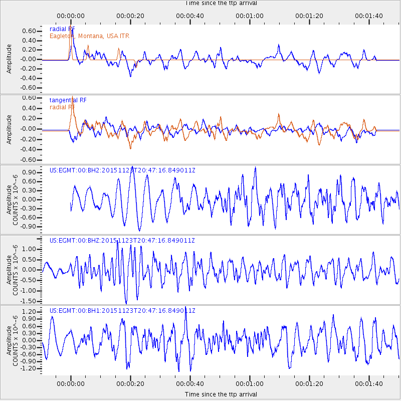
EGMT Eagleton, Montana, USA - Earthquake Result Viewer
*The percent match for this event was below the threshold and hence no stack was calculated.
| Earthquake location: |
Guerrero, Mexico |
| Earthquake latitude/longitude: |
17.1/-98.8 |
| Earthquake time(UTC): |
2015/11/23 (327) 20:41:23 GMT |
| Earthquake Depth: |
38 km |
| Earthquake Magnitude: |
5.5 MB |
| Earthquake Catalog/Contributor: |
NEIC PDE/NEIC COMCAT |
|
| Network: |
US United States National Seismic Network |
| Station: |
EGMT Eagleton, Montana, USA |
| Lat/Lon: |
48.02 N/109.75 W |
| Elevation: |
1055 m |
|
| Distance: |
32.1 deg |
| Az: |
346.14 deg |
| Baz: |
160.048 deg |
| Ray Param: |
$rayparam |
*The percent match for this event was below the threshold and hence was not used in the summary stack. |
|
| Radial Match: |
57.647038 % |
| Radial Bump: |
400 |
| Transverse Match: |
41.307934 % |
| Transverse Bump: |
400 |
| SOD ConfigId: |
1259291 |
| Insert Time: |
2015-12-07 22:42:53.217 +0000 |
| GWidth: |
2.5 |
| Max Bumps: |
400 |
| Tol: |
0.001 |
|
Signal To Noise
| Channel | StoN | STA | LTA |
| US:EGMT:00:BHZ:20151123T20:47:16.849011Z | 2.0155005 | 3.8578693E-7 | 1.9140998E-7 |
| US:EGMT:00:BH1:20151123T20:47:16.849011Z | 0.4388116 | 2.8704855E-7 | 6.5414986E-7 |
| US:EGMT:00:BH2:20151123T20:47:16.849011Z | 0.8341162 | 3.8585065E-7 | 4.625862E-7 |
| Arrivals |
| Ps | |
| PpPs | |
| PsPs/PpSs | |


