You are here: Home > Network List > TA - USArray Transportable Network (new EarthScope stations) Stations List
> Station D25K Kavik River, AK, USA > Earthquake Result Viewer
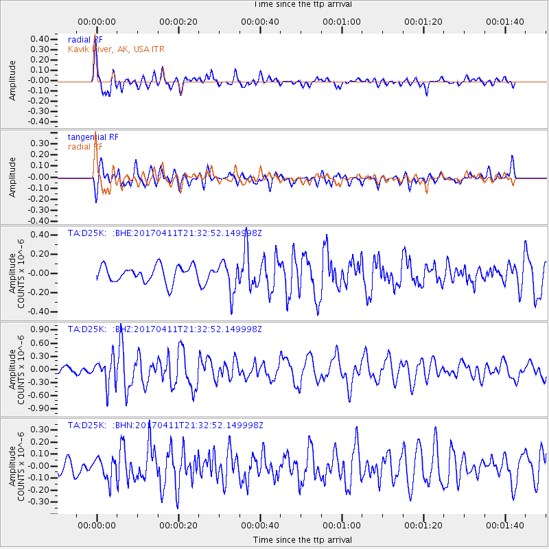
D25K Kavik River, AK, USA - Earthquake Result Viewer
*The percent match for this event was below the threshold and hence no stack was calculated.
| Earthquake location: |
Mindanao, Philippines |
| Earthquake latitude/longitude: |
7.7/124.8 |
| Earthquake time(UTC): |
2017/04/11 (101) 21:21:00 GMT |
| Earthquake Depth: |
6.4 km |
| Earthquake Magnitude: |
5.6 mb |
| Earthquake Catalog/Contributor: |
NEIC PDE/us |
|
| Network: |
TA USArray Transportable Network (new EarthScope stations) |
| Station: |
D25K Kavik River, AK, USA |
| Lat/Lon: |
69.32 N/146.38 W |
| Elevation: |
770 m |
|
| Distance: |
82.5 deg |
| Az: |
20.99 deg |
| Baz: |
271.636 deg |
| Ray Param: |
$rayparam |
*The percent match for this event was below the threshold and hence was not used in the summary stack. |
|
| Radial Match: |
79.47758 % |
| Radial Bump: |
400 |
| Transverse Match: |
67.7175 % |
| Transverse Bump: |
400 |
| SOD ConfigId: |
11737051 |
| Insert Time: |
2019-04-27 02:16:26.426 +0000 |
| GWidth: |
2.5 |
| Max Bumps: |
400 |
| Tol: |
0.001 |
|
Signal To Noise
| Channel | StoN | STA | LTA |
| TA:D25K: :BHZ:20170411T21:32:52.149998Z | 2.719582 | 3.1064715E-7 | 1.1422606E-7 |
| TA:D25K: :BHN:20170411T21:32:52.149998Z | 0.98986924 | 9.072276E-8 | 9.165126E-8 |
| TA:D25K: :BHE:20170411T21:32:52.149998Z | 1.8933204 | 1.6073746E-7 | 8.489712E-8 |
| Arrivals |
| Ps | |
| PpPs | |
| PsPs/PpSs | |


