You are here: Home > Network List > TA - USArray Transportable Network (new EarthScope stations) Stations List
> Station J26L Joseph Creek, AK, USA > Earthquake Result Viewer
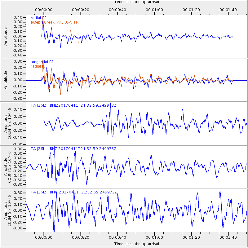
J26L Joseph Creek, AK, USA - Earthquake Result Viewer
*The percent match for this event was below the threshold and hence no stack was calculated.
| Earthquake location: |
Mindanao, Philippines |
| Earthquake latitude/longitude: |
7.7/124.8 |
| Earthquake time(UTC): |
2017/04/11 (101) 21:21:00 GMT |
| Earthquake Depth: |
6.4 km |
| Earthquake Magnitude: |
5.6 mb |
| Earthquake Catalog/Contributor: |
NEIC PDE/us |
|
| Network: |
TA USArray Transportable Network (new EarthScope stations) |
| Station: |
J26L Joseph Creek, AK, USA |
| Lat/Lon: |
64.50 N/143.56 W |
| Elevation: |
1144 m |
|
| Distance: |
83.8 deg |
| Az: |
25.797 deg |
| Baz: |
274.795 deg |
| Ray Param: |
$rayparam |
*The percent match for this event was below the threshold and hence was not used in the summary stack. |
|
| Radial Match: |
78.743324 % |
| Radial Bump: |
400 |
| Transverse Match: |
69.762505 % |
| Transverse Bump: |
352 |
| SOD ConfigId: |
11737051 |
| Insert Time: |
2019-04-27 02:16:48.718 +0000 |
| GWidth: |
2.5 |
| Max Bumps: |
400 |
| Tol: |
0.001 |
|
Signal To Noise
| Channel | StoN | STA | LTA |
| TA:J26L: :BHZ:20170411T21:32:59.249973Z | 3.6976383 | 3.2280468E-7 | 8.7300236E-8 |
| TA:J26L: :BHN:20170411T21:32:59.249973Z | 1.6951606 | 1.0327314E-7 | 6.092233E-8 |
| TA:J26L: :BHE:20170411T21:32:59.249973Z | 1.4578354 | 1.142741E-7 | 7.8386144E-8 |
| Arrivals |
| Ps | |
| PpPs | |
| PsPs/PpSs | |


