You are here: Home > Network List > TA - USArray Transportable Network (new EarthScope stations) Stations List
> Station U26A Atchley Ranch, Grenville, NM, USA > Earthquake Result Viewer
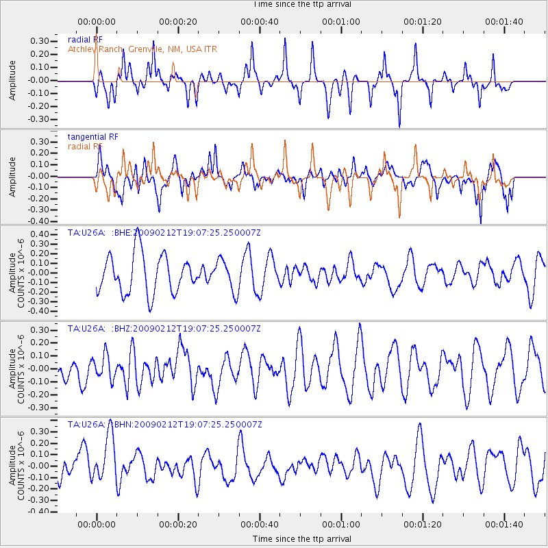
U26A Atchley Ranch, Grenville, NM, USA - Earthquake Result Viewer
*The percent match for this event was below the threshold and hence no stack was calculated.
| Earthquake location: |
Kermadec Islands Region |
| Earthquake latitude/longitude: |
-31.2/-178.1 |
| Earthquake time(UTC): |
2009/02/12 (043) 18:54:28 GMT |
| Earthquake Depth: |
24 km |
| Earthquake Magnitude: |
5.6 MB, 5.6 MS, 5.9 MW, 5.8 MW |
| Earthquake Catalog/Contributor: |
WHDF/NEIC |
|
| Network: |
TA USArray Transportable Network (new EarthScope stations) |
| Station: |
U26A Atchley Ranch, Grenville, NM, USA |
| Lat/Lon: |
36.39 N/103.74 W |
| Elevation: |
1861 m |
|
| Distance: |
96.8 deg |
| Az: |
51.492 deg |
| Baz: |
236.179 deg |
| Ray Param: |
$rayparam |
*The percent match for this event was below the threshold and hence was not used in the summary stack. |
|
| Radial Match: |
63.88051 % |
| Radial Bump: |
313 |
| Transverse Match: |
45.26773 % |
| Transverse Bump: |
400 |
| SOD ConfigId: |
2658 |
| Insert Time: |
2010-03-05 22:56:27.164 +0000 |
| GWidth: |
2.5 |
| Max Bumps: |
400 |
| Tol: |
0.001 |
|
Signal To Noise
| Channel | StoN | STA | LTA |
| TA:U26A: :BHZ:20090212T19:07:25.250007Z | 1.0338765 | 9.3640246E-8 | 9.057197E-8 |
| TA:U26A: :BHN:20090212T19:07:25.250007Z | 1.9729358 | 2.3029045E-7 | 1.16724756E-7 |
| TA:U26A: :BHE:20090212T19:07:25.250007Z | 0.8429471 | 1.6972223E-7 | 2.0134387E-7 |
| Arrivals |
| Ps | |
| PpPs | |
| PsPs/PpSs | |


