You are here: Home > Network List > TA - USArray Transportable Network (new EarthScope stations) Stations List
> Station A36M Sachs Harbour, NT, CAN > Earthquake Result Viewer
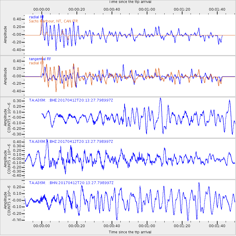
A36M Sachs Harbour, NT, CAN - Earthquake Result Viewer
*The percent match for this event was below the threshold and hence no stack was calculated.
| Earthquake location: |
Mindanao, Philippines |
| Earthquake latitude/longitude: |
7.7/124.9 |
| Earthquake time(UTC): |
2017/04/12 (102) 20:01:05 GMT |
| Earthquake Depth: |
10 km |
| Earthquake Magnitude: |
5.5 Mww |
| Earthquake Catalog/Contributor: |
NEIC PDE/us |
|
| Network: |
TA USArray Transportable Network (new EarthScope stations) |
| Station: |
A36M Sachs Harbour, NT, CAN |
| Lat/Lon: |
71.99 N/125.25 W |
| Elevation: |
32 m |
|
| Distance: |
88.7 deg |
| Az: |
17.015 deg |
| Baz: |
291.227 deg |
| Ray Param: |
$rayparam |
*The percent match for this event was below the threshold and hence was not used in the summary stack. |
|
| Radial Match: |
67.94509 % |
| Radial Bump: |
400 |
| Transverse Match: |
66.234314 % |
| Transverse Bump: |
400 |
| SOD ConfigId: |
11737051 |
| Insert Time: |
2019-04-27 02:23:05.087 +0000 |
| GWidth: |
2.5 |
| Max Bumps: |
400 |
| Tol: |
0.001 |
|
Signal To Noise
| Channel | StoN | STA | LTA |
| TA:A36M: :BHZ:20170412T20:13:27.798997Z | 3.207477 | 2.2325312E-7 | 6.960396E-8 |
| TA:A36M: :BHN:20170412T20:13:27.798997Z | 0.74861705 | 6.538407E-8 | 8.7339814E-8 |
| TA:A36M: :BHE:20170412T20:13:27.798997Z | 1.1884668 | 7.311477E-8 | 6.152025E-8 |
| Arrivals |
| Ps | |
| PpPs | |
| PsPs/PpSs | |


