You are here: Home > Network List > TA - USArray Transportable Network (new EarthScope stations) Stations List
> Station U26A Atchley Ranch, Grenville, NM, USA > Earthquake Result Viewer
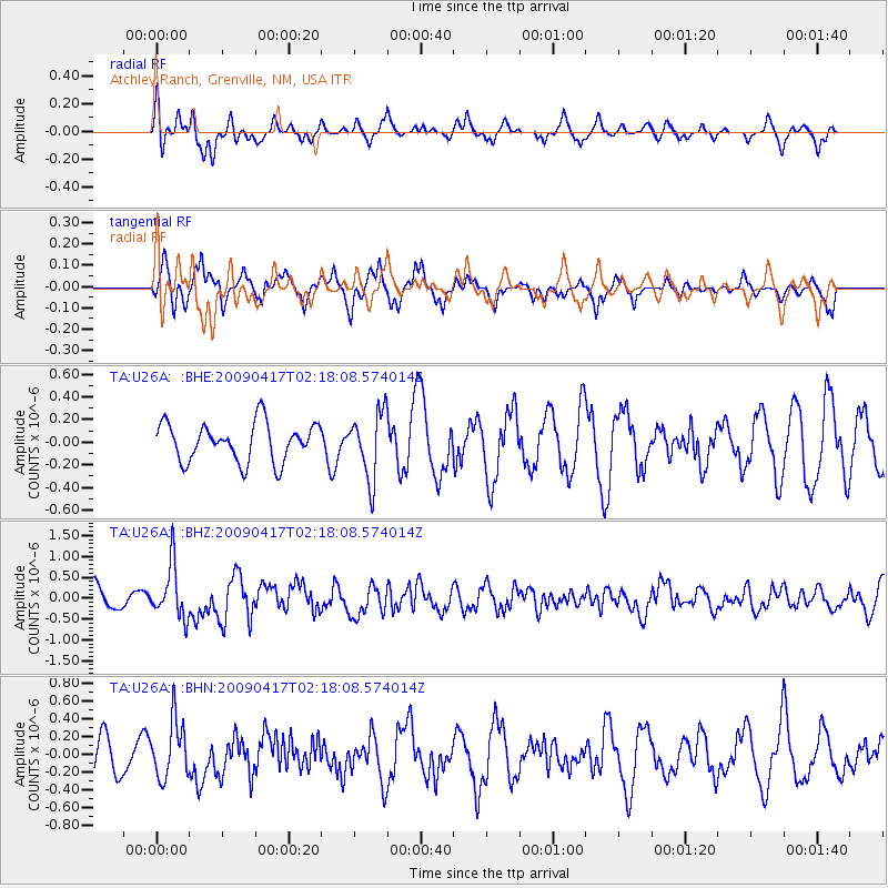
U26A Atchley Ranch, Grenville, NM, USA - Earthquake Result Viewer
*The percent match for this event was below the threshold and hence no stack was calculated.
| Earthquake location: |
Near Coast Of Northern Chile |
| Earthquake latitude/longitude: |
-19.6/-70.5 |
| Earthquake time(UTC): |
2009/04/17 (107) 02:08:08 GMT |
| Earthquake Depth: |
25 km |
| Earthquake Magnitude: |
5.8 MB, 5.8 MS, 6.1 MW, 6.1 MW |
| Earthquake Catalog/Contributor: |
WHDF/NEIC |
|
| Network: |
TA USArray Transportable Network (new EarthScope stations) |
| Station: |
U26A Atchley Ranch, Grenville, NM, USA |
| Lat/Lon: |
36.39 N/103.74 W |
| Elevation: |
1861 m |
|
| Distance: |
63.9 deg |
| Az: |
330.489 deg |
| Baz: |
144.857 deg |
| Ray Param: |
$rayparam |
*The percent match for this event was below the threshold and hence was not used in the summary stack. |
|
| Radial Match: |
64.5153 % |
| Radial Bump: |
400 |
| Transverse Match: |
76.78189 % |
| Transverse Bump: |
394 |
| SOD ConfigId: |
2658 |
| Insert Time: |
2010-03-05 22:56:54.206 +0000 |
| GWidth: |
2.5 |
| Max Bumps: |
400 |
| Tol: |
0.001 |
|
Signal To Noise
| Channel | StoN | STA | LTA |
| TA:U26A: :BHZ:20090417T02:18:08.574014Z | 2.7472177 | 6.3349444E-7 | 2.3059492E-7 |
| TA:U26A: :BHN:20090417T02:18:08.574014Z | 1.4531032 | 3.2387277E-7 | 2.2288353E-7 |
| TA:U26A: :BHE:20090417T02:18:08.574014Z | 1.7355567 | 2.9276254E-7 | 1.6868508E-7 |
| Arrivals |
| Ps | |
| PpPs | |
| PsPs/PpSs | |


