You are here: Home > Network List > AK - Alaska Regional Network Stations List
> Station CUT Chulitna, AK, USA > Earthquake Result Viewer
CUT Chulitna, AK, USA - Earthquake Result Viewer
*The percent match for this event was below the threshold and hence no stack was calculated.
| Earthquake location: |
Philippine Islands Region |
| Earthquake latitude/longitude: |
5.7/127.3 |
| Earthquake time(UTC): |
2017/04/13 (103) 16:05:46 GMT |
| Earthquake Depth: |
10 km |
| Earthquake Magnitude: |
5.5 Mww |
| Earthquake Catalog/Contributor: |
NEIC PDE/us |
|
| Network: |
AK Alaska Regional Network |
| Station: |
CUT Chulitna, AK, USA |
| Lat/Lon: |
62.41 N/150.26 W |
| Elevation: |
574 m |
|
| Distance: |
81.4 deg |
| Az: |
27.826 deg |
| Baz: |
265.95 deg |
| Ray Param: |
$rayparam |
*The percent match for this event was below the threshold and hence was not used in the summary stack. |
|
| Radial Match: |
50.534973 % |
| Radial Bump: |
400 |
| Transverse Match: |
57.98226 % |
| Transverse Bump: |
400 |
| SOD ConfigId: |
11737051 |
| Insert Time: |
2019-04-27 02:25:36.841 +0000 |
| GWidth: |
2.5 |
| Max Bumps: |
400 |
| Tol: |
0.001 |
|
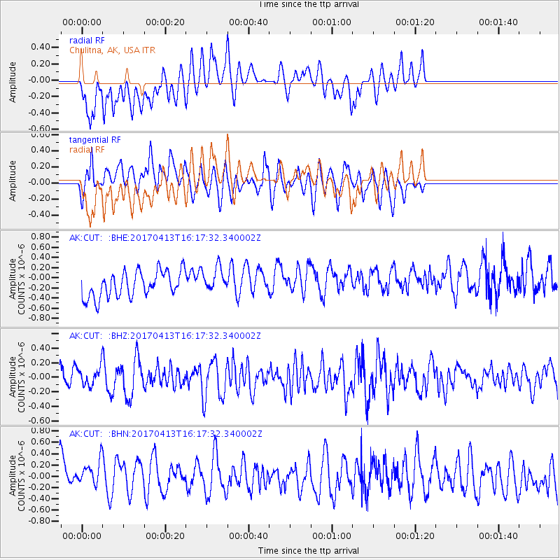
Signal To Noise
| Channel | StoN | STA | LTA |
| AK:CUT: :BHZ:20170413T16:17:32.340002Z | 0.93773204 | 1.1895181E-7 | 1.2685054E-7 |
| AK:CUT: :BHN:20170413T16:17:32.340002Z | 1.0342143 | 2.791955E-7 | 2.6995903E-7 |
| AK:CUT: :BHE:20170413T16:17:32.340002Z | 0.98004425 | 2.4972178E-7 | 2.5480662E-7 |
| Arrivals |
| Ps | |
| PpPs | |
| PsPs/PpSs | |


