You are here: Home > Network List > TA - USArray Transportable Network (new EarthScope stations) Stations List
> Station U26A Atchley Ranch, Grenville, NM, USA > Earthquake Result Viewer
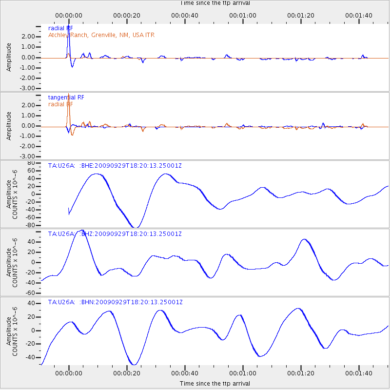
U26A Atchley Ranch, Grenville, NM, USA - Earthquake Result Viewer
*The percent match for this event was below the threshold and hence no stack was calculated.
| Earthquake location: |
Samoa Islands Region |
| Earthquake latitude/longitude: |
-15.6/-172.0 |
| Earthquake time(UTC): |
2009/09/29 (272) 18:08:21 GMT |
| Earthquake Depth: |
10 km |
| Earthquake Magnitude: |
5.6 MB |
| Earthquake Catalog/Contributor: |
WHDF/NEIC |
|
| Network: |
TA USArray Transportable Network (new EarthScope stations) |
| Station: |
U26A Atchley Ranch, Grenville, NM, USA |
| Lat/Lon: |
36.39 N/103.74 W |
| Elevation: |
1861 m |
|
| Distance: |
82.5 deg |
| Az: |
49.111 deg |
| Baz: |
244.563 deg |
| Ray Param: |
$rayparam |
*The percent match for this event was below the threshold and hence was not used in the summary stack. |
|
| Radial Match: |
68.463234 % |
| Radial Bump: |
400 |
| Transverse Match: |
52.241726 % |
| Transverse Bump: |
274 |
| SOD ConfigId: |
2622 |
| Insert Time: |
2010-03-05 22:57:13.175 +0000 |
| GWidth: |
2.5 |
| Max Bumps: |
400 |
| Tol: |
0.001 |
|
Signal To Noise
| Channel | StoN | STA | LTA |
| TA:U26A: :BHZ:20090929T18:20:13.25001Z | 2.2280226 | 5.4811702E-5 | 2.4601055E-5 |
| TA:U26A: :BHN:20090929T18:20:13.25001Z | 0.23141377 | 1.0191815E-5 | 4.4041524E-5 |
| TA:U26A: :BHE:20090929T18:20:13.25001Z | 1.1188569 | 5.3505355E-5 | 4.7821446E-5 |
| Arrivals |
| Ps | |
| PpPs | |
| PsPs/PpSs | |


