You are here: Home > Network List > CI - Caltech Regional Seismic Network Stations List
> Station DAN Danby, California, USA > Earthquake Result Viewer
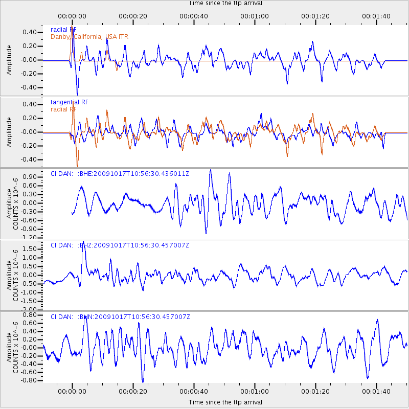
DAN Danby, California, USA - Earthquake Result Viewer
*The percent match for this event was below the threshold and hence no stack was calculated.
| Earthquake location: |
Samoa Islands Region |
| Earthquake latitude/longitude: |
-16.4/-172.0 |
| Earthquake time(UTC): |
2009/10/17 (290) 10:45:26 GMT |
| Earthquake Depth: |
10 km |
| Earthquake Magnitude: |
5.7 MB, 5.3 MS, 5.7 MW, 5.7 MW |
| Earthquake Catalog/Contributor: |
WHDF/NEIC |
|
| Network: |
CI Caltech Regional Seismic Network |
| Station: |
DAN Danby, California, USA |
| Lat/Lon: |
34.64 N/115.38 W |
| Elevation: |
398 m |
|
| Distance: |
73.9 deg |
| Az: |
45.767 deg |
| Baz: |
236.533 deg |
| Ray Param: |
$rayparam |
*The percent match for this event was below the threshold and hence was not used in the summary stack. |
|
| Radial Match: |
68.60964 % |
| Radial Bump: |
400 |
| Transverse Match: |
57.582413 % |
| Transverse Bump: |
400 |
| SOD ConfigId: |
2622 |
| Insert Time: |
2010-02-26 01:06:24.483 +0000 |
| GWidth: |
2.5 |
| Max Bumps: |
400 |
| Tol: |
0.001 |
|
Signal To Noise
| Channel | StoN | STA | LTA |
| CI:DAN: :BHZ:20091017T10:56:30.457007Z | 2.3135211 | 8.239335E-7 | 3.561383E-7 |
| CI:DAN: :BHN:20091017T10:56:30.457007Z | 0.9118948 | 3.5487471E-7 | 3.891619E-7 |
| CI:DAN: :BHE:20091017T10:56:30.436011Z | 1.3732239 | 3.1683783E-7 | 2.3072553E-7 |
| Arrivals |
| Ps | |
| PpPs | |
| PsPs/PpSs | |


