You are here: Home > Network List > TA - USArray Transportable Network (new EarthScope stations) Stations List
> Station U26A Atchley Ranch, Grenville, NM, USA > Earthquake Result Viewer
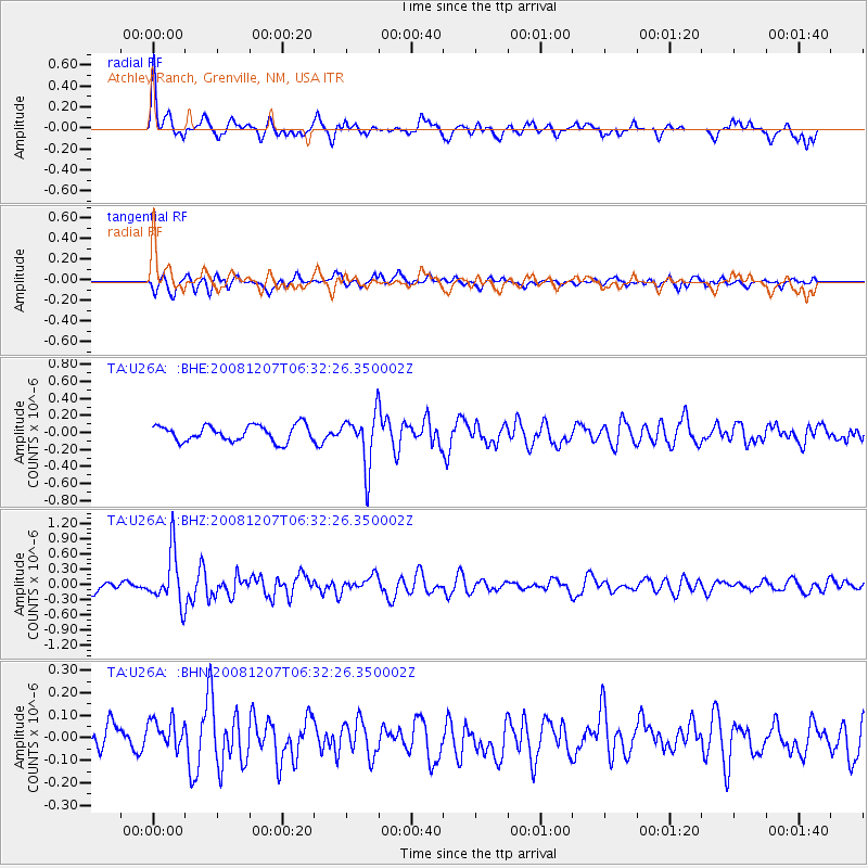
U26A Atchley Ranch, Grenville, NM, USA - Earthquake Result Viewer
*The percent match for this event was below the threshold and hence no stack was calculated.
| Earthquake location: |
Northern Mid-Atlantic Ridge |
| Earthquake latitude/longitude: |
13.4/-44.8 |
| Earthquake time(UTC): |
2008/12/07 (342) 06:23:09 GMT |
| Earthquake Depth: |
10 km |
| Earthquake Magnitude: |
5.6 MB, 5.3 MS, 5.7 MW |
| Earthquake Catalog/Contributor: |
WHDF/NEIC |
|
| Network: |
TA USArray Transportable Network (new EarthScope stations) |
| Station: |
U26A Atchley Ranch, Grenville, NM, USA |
| Lat/Lon: |
36.39 N/103.74 W |
| Elevation: |
1861 m |
|
| Distance: |
57.2 deg |
| Az: |
304.753 deg |
| Baz: |
97.634 deg |
| Ray Param: |
$rayparam |
*The percent match for this event was below the threshold and hence was not used in the summary stack. |
|
| Radial Match: |
72.83383 % |
| Radial Bump: |
400 |
| Transverse Match: |
68.51788 % |
| Transverse Bump: |
400 |
| SOD ConfigId: |
2658 |
| Insert Time: |
2010-03-05 22:57:41.174 +0000 |
| GWidth: |
2.5 |
| Max Bumps: |
400 |
| Tol: |
0.001 |
|
Signal To Noise
| Channel | StoN | STA | LTA |
| TA:U26A: :BHZ:20081207T06:32:26.350002Z | 4.6657686 | 5.120627E-7 | 1.0974883E-7 |
| TA:U26A: :BHN:20081207T06:32:26.350002Z | 1.2024701 | 6.8870044E-8 | 5.7273812E-8 |
| TA:U26A: :BHE:20081207T06:32:26.350002Z | 3.2956288 | 3.0917968E-7 | 9.381508E-8 |
| Arrivals |
| Ps | |
| PpPs | |
| PsPs/PpSs | |


