You are here: Home > Network List > TA - USArray Transportable Network (new EarthScope stations) Stations List
> Station G21K Allakaket, AK, USA > Earthquake Result Viewer
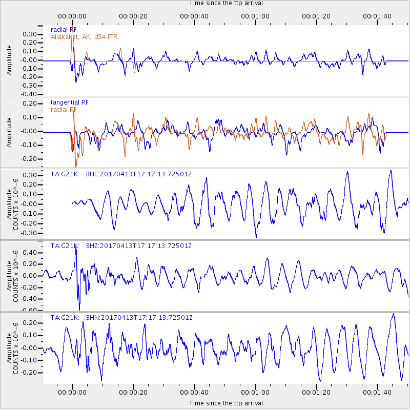
G21K Allakaket, AK, USA - Earthquake Result Viewer
*The percent match for this event was below the threshold and hence no stack was calculated.
| Earthquake location: |
Fiji Islands Region |
| Earthquake latitude/longitude: |
-18.3/-178.2 |
| Earthquake time(UTC): |
2017/04/13 (103) 17:05:54 GMT |
| Earthquake Depth: |
494 km |
| Earthquake Magnitude: |
5.8 Mww |
| Earthquake Catalog/Contributor: |
NEIC PDE/us |
|
| Network: |
TA USArray Transportable Network (new EarthScope stations) |
| Station: |
G21K Allakaket, AK, USA |
| Lat/Lon: |
66.52 N/153.51 W |
| Elevation: |
446 m |
|
| Distance: |
86.5 deg |
| Az: |
9.639 deg |
| Baz: |
203.389 deg |
| Ray Param: |
$rayparam |
*The percent match for this event was below the threshold and hence was not used in the summary stack. |
|
| Radial Match: |
42.81196 % |
| Radial Bump: |
400 |
| Transverse Match: |
25.215574 % |
| Transverse Bump: |
237 |
| SOD ConfigId: |
11737051 |
| Insert Time: |
2019-04-27 02:34:20.803 +0000 |
| GWidth: |
2.5 |
| Max Bumps: |
400 |
| Tol: |
0.001 |
|
Signal To Noise
| Channel | StoN | STA | LTA |
| TA:G21K: :BHZ:20170413T17:17:13.72501Z | 2.5020053 | 2.347842E-7 | 9.383841E-8 |
| TA:G21K: :BHN:20170413T17:17:13.72501Z | 1.2441436 | 1.00074985E-7 | 8.043685E-8 |
| TA:G21K: :BHE:20170413T17:17:13.72501Z | 0.9179683 | 7.8521566E-8 | 8.553843E-8 |
| Arrivals |
| Ps | |
| PpPs | |
| PsPs/PpSs | |


