You are here: Home > Network List > TA - USArray Transportable Network (new EarthScope stations) Stations List
> Station J26L Joseph Creek, AK, USA > Earthquake Result Viewer
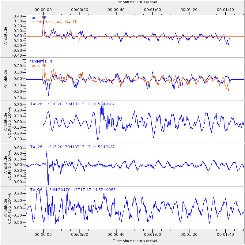
J26L Joseph Creek, AK, USA - Earthquake Result Viewer
*The percent match for this event was below the threshold and hence no stack was calculated.
| Earthquake location: |
Fiji Islands Region |
| Earthquake latitude/longitude: |
-18.3/-178.2 |
| Earthquake time(UTC): |
2017/04/13 (103) 17:05:54 GMT |
| Earthquake Depth: |
494 km |
| Earthquake Magnitude: |
5.8 Mww |
| Earthquake Catalog/Contributor: |
NEIC PDE/us |
|
| Network: |
TA USArray Transportable Network (new EarthScope stations) |
| Station: |
J26L Joseph Creek, AK, USA |
| Lat/Lon: |
64.50 N/143.56 W |
| Elevation: |
1144 m |
|
| Distance: |
86.7 deg |
| Az: |
14.249 deg |
| Baz: |
212.704 deg |
| Ray Param: |
$rayparam |
*The percent match for this event was below the threshold and hence was not used in the summary stack. |
|
| Radial Match: |
39.970314 % |
| Radial Bump: |
350 |
| Transverse Match: |
53.114063 % |
| Transverse Bump: |
342 |
| SOD ConfigId: |
11737051 |
| Insert Time: |
2019-04-27 02:34:29.173 +0000 |
| GWidth: |
2.5 |
| Max Bumps: |
400 |
| Tol: |
0.001 |
|
Signal To Noise
| Channel | StoN | STA | LTA |
| TA:J26L: :BHZ:20170413T17:17:14.524998Z | 4.34004 | 3.6308492E-7 | 8.3659344E-8 |
| TA:J26L: :BHN:20170413T17:17:14.524998Z | 1.5398232 | 1.2146236E-7 | 7.8880724E-8 |
| TA:J26L: :BHE:20170413T17:17:14.524998Z | 2.682742 | 1.9080522E-7 | 7.112321E-8 |
| Arrivals |
| Ps | |
| PpPs | |
| PsPs/PpSs | |


