You are here: Home > Network List > CI - Caltech Regional Seismic Network Stations List
> Station DAN Danby, California, USA > Earthquake Result Viewer
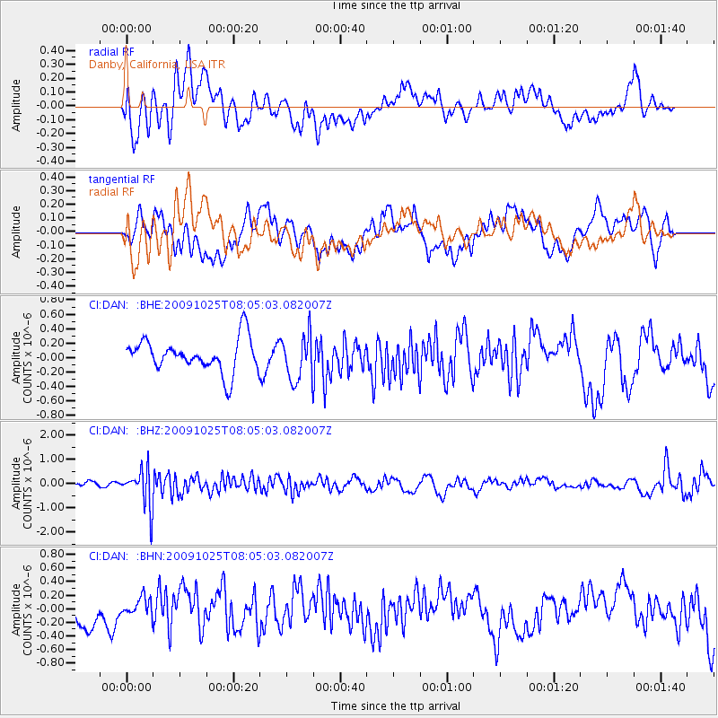
DAN Danby, California, USA - Earthquake Result Viewer
*The percent match for this event was below the threshold and hence no stack was calculated.
| Earthquake location: |
South Of Fiji Islands |
| Earthquake latitude/longitude: |
-23.1/-179.2 |
| Earthquake time(UTC): |
2009/10/25 (298) 07:53:52 GMT |
| Earthquake Depth: |
418 km |
| Earthquake Magnitude: |
5.6 MB, 6.0 MW, 5.9 MW |
| Earthquake Catalog/Contributor: |
WHDF/NEIC |
|
| Network: |
CI Caltech Regional Seismic Network |
| Station: |
DAN Danby, California, USA |
| Lat/Lon: |
34.64 N/115.38 W |
| Elevation: |
398 m |
|
| Distance: |
83.4 deg |
| Az: |
48.148 deg |
| Baz: |
236.289 deg |
| Ray Param: |
$rayparam |
*The percent match for this event was below the threshold and hence was not used in the summary stack. |
|
| Radial Match: |
73.99476 % |
| Radial Bump: |
400 |
| Transverse Match: |
62.400085 % |
| Transverse Bump: |
400 |
| SOD ConfigId: |
2622 |
| Insert Time: |
2010-02-26 01:06:26.250 +0000 |
| GWidth: |
2.5 |
| Max Bumps: |
400 |
| Tol: |
0.001 |
|
Signal To Noise
| Channel | StoN | STA | LTA |
| CI:DAN: :BHZ:20091025T08:05:03.082007Z | 4.7901216 | 7.9644497E-7 | 1.6626821E-7 |
| CI:DAN: :BHN:20091025T08:05:03.082007Z | 0.65408313 | 1.5306385E-7 | 2.3401283E-7 |
| CI:DAN: :BHE:20091025T08:05:03.082007Z | 1.4168502 | 3.2181194E-7 | 2.2713193E-7 |
| Arrivals |
| Ps | |
| PpPs | |
| PsPs/PpSs | |


