You are here: Home > Network List > TA - USArray Transportable Network (new EarthScope stations) Stations List
> Station R31K City Hall, Gustavus, AK, USA > Earthquake Result Viewer
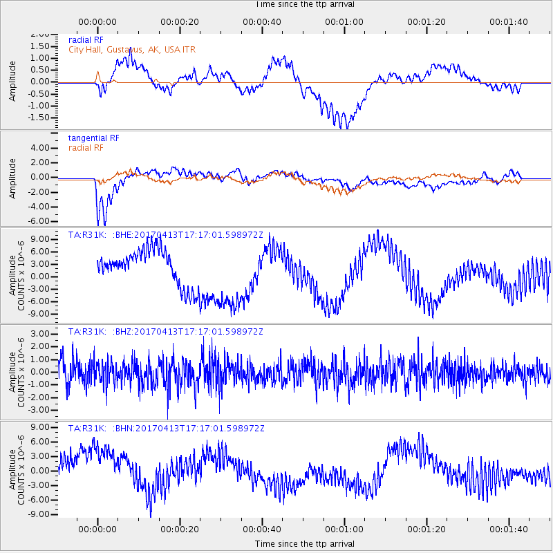
R31K City Hall, Gustavus, AK, USA - Earthquake Result Viewer
*The percent match for this event was below the threshold and hence no stack was calculated.
| Earthquake location: |
Fiji Islands Region |
| Earthquake latitude/longitude: |
-18.3/-178.2 |
| Earthquake time(UTC): |
2017/04/13 (103) 17:05:54 GMT |
| Earthquake Depth: |
494 km |
| Earthquake Magnitude: |
5.8 Mww |
| Earthquake Catalog/Contributor: |
NEIC PDE/us |
|
| Network: |
TA USArray Transportable Network (new EarthScope stations) |
| Station: |
R31K City Hall, Gustavus, AK, USA |
| Lat/Lon: |
58.41 N/135.74 W |
| Elevation: |
15 m |
|
| Distance: |
84.0 deg |
| Az: |
20.913 deg |
| Baz: |
220.118 deg |
| Ray Param: |
$rayparam |
*The percent match for this event was below the threshold and hence was not used in the summary stack. |
|
| Radial Match: |
72.459206 % |
| Radial Bump: |
400 |
| Transverse Match: |
45.216583 % |
| Transverse Bump: |
400 |
| SOD ConfigId: |
11737051 |
| Insert Time: |
2019-04-27 02:34:58.901 +0000 |
| GWidth: |
2.5 |
| Max Bumps: |
400 |
| Tol: |
0.001 |
|
Signal To Noise
| Channel | StoN | STA | LTA |
| TA:R31K: :BHZ:20170413T17:17:01.598972Z | 1.0103854 | 8.5488307E-7 | 8.4609604E-7 |
| TA:R31K: :BHN:20170413T17:17:01.598972Z | 2.3610203 | 6.587545E-6 | 2.7901265E-6 |
| TA:R31K: :BHE:20170413T17:17:01.598972Z | 2.181819 | 9.036347E-6 | 4.141658E-6 |
| Arrivals |
| Ps | |
| PpPs | |
| PsPs/PpSs | |


