You are here: Home > Network List > UW - Pacific Northwest Regional Seismic Network Stations List
> Station UMAT Pilot Rock, OR, USA > Earthquake Result Viewer
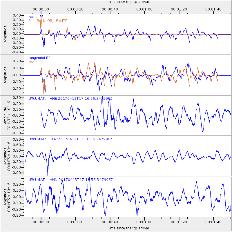
UMAT Pilot Rock, OR, USA - Earthquake Result Viewer
*The percent match for this event was below the threshold and hence no stack was calculated.
| Earthquake location: |
Fiji Islands Region |
| Earthquake latitude/longitude: |
-18.3/-178.2 |
| Earthquake time(UTC): |
2017/04/13 (103) 17:05:54 GMT |
| Earthquake Depth: |
494 km |
| Earthquake Magnitude: |
5.8 Mww |
| Earthquake Catalog/Contributor: |
NEIC PDE/us |
|
| Network: |
UW Pacific Northwest Regional Seismic Network |
| Station: |
UMAT Pilot Rock, OR, USA |
| Lat/Lon: |
45.29 N/118.96 W |
| Elevation: |
1318 m |
|
| Distance: |
83.0 deg |
| Az: |
37.656 deg |
| Baz: |
235.316 deg |
| Ray Param: |
$rayparam |
*The percent match for this event was below the threshold and hence was not used in the summary stack. |
|
| Radial Match: |
63.260975 % |
| Radial Bump: |
400 |
| Transverse Match: |
41.835377 % |
| Transverse Bump: |
376 |
| SOD ConfigId: |
11737051 |
| Insert Time: |
2019-04-27 02:35:43.829 +0000 |
| GWidth: |
2.5 |
| Max Bumps: |
400 |
| Tol: |
0.001 |
|
Signal To Noise
| Channel | StoN | STA | LTA |
| UW:UMAT: :HHZ:20170413T17:16:56.347996Z | 2.338331 | 3.1266336E-7 | 1.3371219E-7 |
| UW:UMAT: :HHN:20170413T17:16:56.347996Z | 1.3552417 | 1.424711E-7 | 1.0512596E-7 |
| UW:UMAT: :HHE:20170413T17:16:56.347996Z | 1.434984 | 1.1732415E-7 | 8.17599E-8 |
| Arrivals |
| Ps | |
| PpPs | |
| PsPs/PpSs | |


